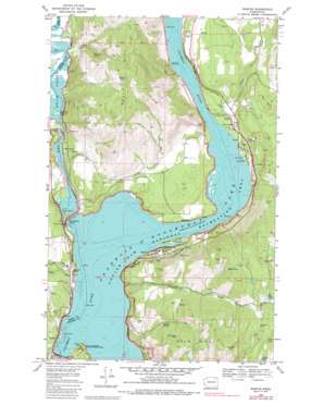
Marcus Topo Map Washington
To zoom in, hover over the map of Marcus
USGS Topo Quad 48118f1 - 1:24,000 scale
| Topo Map Name: | Marcus |
| USGS Topo Quad ID: | 48118f1 |
| Print Size: | ca. 21 1/4" wide x 27" high |
| Southeast Coordinates: | 48.625° N latitude / 118° W longitude |
| Map Center Coordinates: | 48.6875° N latitude / 118.0625° W longitude |
| U.S. State: | WA |
| Filename: | o48118f1.jpg |
| Download Map JPG Image: | Marcus topo map 1:24,000 scale |
| Map Type: | Topographic |
| Topo Series: | 7.5´ |
| Map Scale: | 1:24,000 |
| Source of Map Images: | United States Geological Survey (USGS) |
| Alternate Map Versions: |
Marcus WA 1969, updated 1972 Download PDF Buy paper map Marcus WA 1969, updated 1986 Download PDF Buy paper map Marcus WA 2011 Download PDF Buy paper map Marcus WA 2014 Download PDF Buy paper map |
1:24,000 Topo Quads surrounding Marcus
> Back to 48118e1 at 1:100,000 scale
> Back to 48118a1 at 1:250,000 scale
> Back to U.S. Topo Maps home
Marcus topo map: Gazetteer
Marcus: Areas
Pot Holes elevation 564m 1850′Marcus: Bars
Marcus Flats elevation 394m 1292′Marcus Flats elevation 394m 1292′
Six Mile Bar (historical) elevation 395m 1295′
Marcus: Bays
Kettle River Arm elevation 394m 1292′Marcus: Bridges
Hedlund Bridge elevation 403m 1322′Marcus: Cliffs
Seven Devils elevation 542m 1778′Marcus: Falls
Kettle Falls (historical) elevation 394m 1292′Marcus: Islands
Kamloops Island elevation 416m 1364′Marcus Island elevation 394m 1292′
Marcus: Lakes
Bass Lake elevation 755m 2477′Evans Pond elevation 406m 1332′
Harlin Lake elevation 836m 2742′
Hill Lake elevation 713m 2339′
Hyatt Lake elevation 792m 2598′
Turtle Lake elevation 733m 2404′
Marcus: Mines
Columbia Quarry elevation 474m 1555′Dipper Mine elevation 886m 2906′
Gold Ledge Mine elevation 804m 2637′
Gold Reef Mine elevation 959m 3146′
Kifer Quarry elevation 515m 1689′
Napoleon Mine elevation 611m 2004′
Vanasse Mine elevation 747m 2450′
Marcus: Parks
Saint Pauls Mission State Historical Site elevation 419m 1374′Marcus: Populated Places
Bear elevation 580m 1902′Blue Town (historical) elevation 400m 1312′
East Marcus elevation 456m 1496′
Evans elevation 403m 1322′
Godfrey (historical) elevation 440m 1443′
Harter elevation 405m 1328′
Marcus elevation 424m 1391′
Powell elevation 398m 1305′
Marcus: Springs
Martin Spring elevation 601m 1971′Marcus: Streams
China Creek elevation 395m 1295′Deadman Creek elevation 395m 1295′
Katy Creek elevation 430m 1410′
Kettle River elevation 394m 1292′
Nancy Creek elevation 395m 1295′
Pingston Creek elevation 404m 1325′
Marcus: Summits
Gold Hill elevation 915m 3001′Kelley Mountain elevation 833m 2732′
Kelly Hill elevation 870m 2854′
Marcus digital topo map on disk
Buy this Marcus topo map showing relief, roads, GPS coordinates and other geographical features, as a high-resolution digital map file on DVD:


