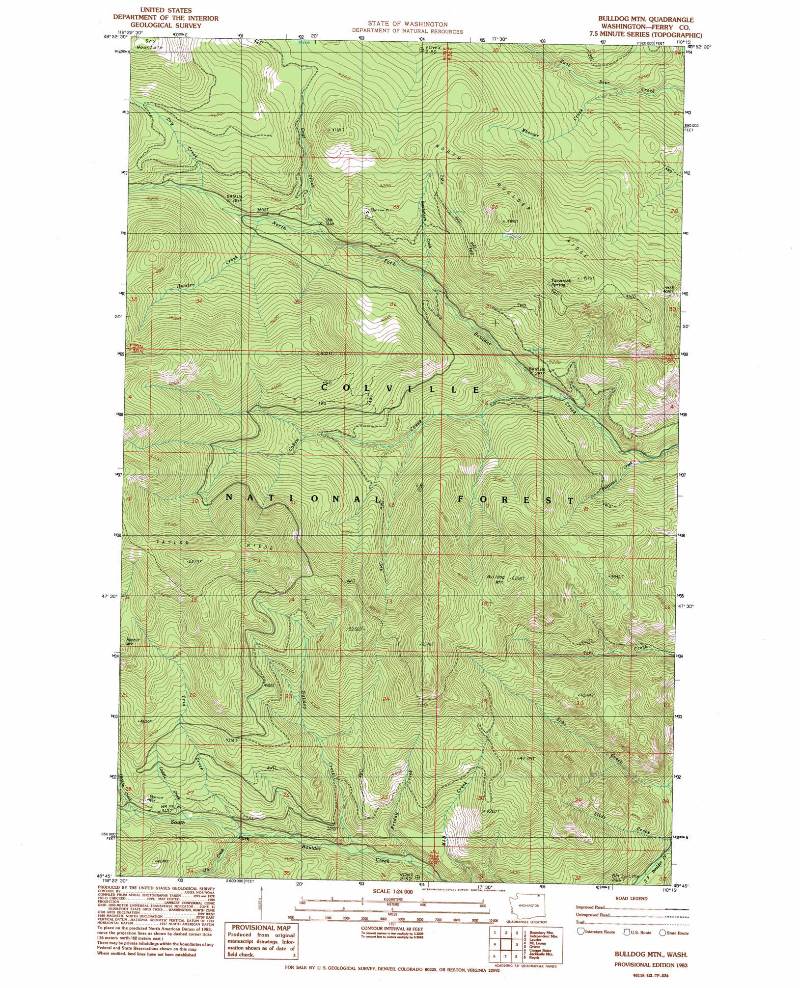
Bulldog Mountain Topo Map Washington
To zoom in, hover over the map of Bulldog Mountain
USGS Topo Quad 48118g3 - 1:24,000 scale
| Topo Map Name: | Bulldog Mountain |
| USGS Topo Quad ID: | 48118g3 |
| Print Size: | ca. 21 1/4" wide x 27" high |
| Southeast Coordinates: | 48.75° N latitude / 118.25° W longitude |
| Map Center Coordinates: | 48.8125° N latitude / 118.3125° W longitude |
| U.S. State: | WA |
| Filename: | o48118g3.jpg |
| Download Map JPG Image: | Bulldog Mountain topo map 1:24,000 scale |
| Map Type: | Topographic |
| Topo Series: | 7.5´ |
| Map Scale: | 1:24,000 |
| Source of Map Images: | United States Geological Survey (USGS) |
| Alternate Map Versions: |
Bulldog Mtn WA 1983, updated 1983 Download PDF Buy paper map Bulldog Mtn WA 1992, updated 1996 Download PDF Buy paper map Bulldog Mountain WA 2011 Download PDF Buy paper map Bulldog Mountain WA 2014 Download PDF Buy paper map |
| FStopo: | US Forest Service topo Bulldog Mountain is available: Download FStopo PDF Download FStopo TIF |
1:24,000 Topo Quads surrounding Bulldog Mountain
Curlew |
Boundary Mountain |
Independent Mountain |
Laurier |
Churchill Mountain |
Malo |
Mount Leona |
Bulldog Mountain |
Orient |
Bossburg |
Cooke Mountain |
Copper Butte |
Jackknife Mountain |
Boyds |
Marcus |
Edds Mountain |
Sherman Peak |
South Huckleberry Mountain |
Bangs Mountain |
Kettle Falls |
> Back to 48118e1 at 1:100,000 scale
> Back to 48118a1 at 1:250,000 scale
> Back to U.S. Topo Maps home
Bulldog Mountain topo map: Gazetteer
Bulldog Mountain: Ridges
North Boulder Ridge elevation 1492m 4895′Bulldog Mountain: Springs
Tamarack spring elevation 1277m 4189′Bulldog Mountain: Streams
Bulldog Creek elevation 964m 3162′Butte Fork elevation 1262m 4140′
Cabin Creek elevation 868m 2847′
Dry Creek elevation 1173m 3848′
Friday Creek elevation 955m 3133′
Goat Creek elevation 1093m 3585′
Hunter Creek elevation 1147m 3763′
Indian Creek elevation 1101m 3612′
Laddie Creek elevation 1067m 3500′
Roesheisen Creek elevation 1000m 3280′
Slide Creek elevation 780m 2559′
Trio Creek elevation 1032m 3385′
U S Creek elevation 1031m 3382′
Wheeler Creek elevation 933m 3061′
Williams Creek elevation 765m 2509′
Bulldog Mountain: Summits
Bulldog Mountain elevation 1578m 5177′Dry Mountain elevation 1618m 5308′
Bulldog Mountain digital topo map on disk
Buy this Bulldog Mountain topo map showing relief, roads, GPS coordinates and other geographical features, as a high-resolution digital map file on DVD: