Boundary Mountain Topo Map Washington
To zoom in, hover over the map of Boundary Mountain
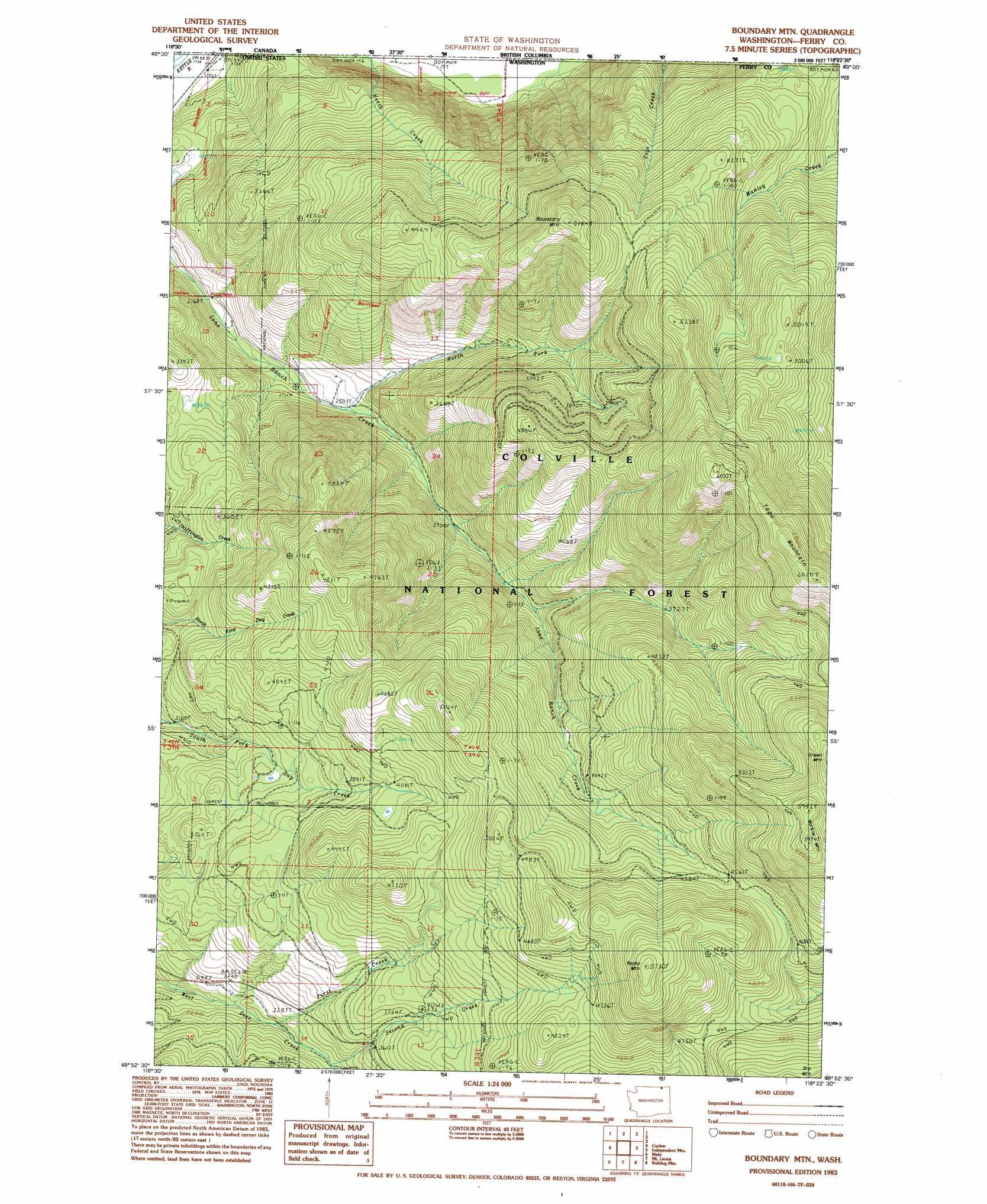
USGS Topo Quad 48118h4 - 1:24,000 scale
| Topo Map Name: | Boundary Mountain |
| USGS Topo Quad ID: | 48118h4 |
| Print Size: | ca. 21 1/4" wide x 27" high |
| Southeast Coordinates: | 48.875° N latitude / 118.375° W longitude |
| Map Center Coordinates: | 48.9375° N latitude / 118.4375° W longitude |
| U.S. State: | WA |
| Filename: | o48118h4.jpg |
| Download Map JPG Image: | Boundary Mountain topo map 1:24,000 scale |
| Map Type: | Topographic |
| Topo Series: | 7.5´ |
| Map Scale: | 1:24,000 |
| Source of Map Images: | United States Geological Survey (USGS) |
| Alternate Map Versions: |
Boundary Mtn WA 1983, updated 1983 Download PDF Buy paper map Boundary Mtn WA 1992, updated 1996 Download PDF Buy paper map Boundary Mountain WA 2011 Download PDF Buy paper map Boundary Mountain WA 2014 Download PDF Buy paper map |
| FStopo: | US Forest Service topo Boundary Mountain is available: Download FStopo PDF Download FStopo TIF |
1:24,000 Topo Quads surrounding Boundary Mountain
Vulcan Mountain |
Curlew |
Boundary Mountain |
Independent Mountain |
Laurier |
Karamin |
Malo |
Mount Leona |
Bulldog Mountain |
Orient |
Republic |
Cooke Mountain |
Copper Butte |
Jackknife Mountain |
Boyds |
> Back to 48118e1 at 1:100,000 scale
> Back to 48118a1 at 1:250,000 scale
> Back to U.S. Topo Maps home
Boundary Mountain topo map: Gazetteer
Boundary Mountain: Springs
Noonday Spring elevation 1493m 4898′Boundary Mountain: Streams
First Creek elevation 972m 3188′North Fork Lone Ranch Creek elevation 759m 2490′
Second Creek elevation 1018m 3339′
Boundary Mountain: Summits
Boundary Mountain elevation 1566m 5137′Marble Mountain elevation 1791m 5875′
Rocky Mountain elevation 1735m 5692′
Boundary Mountain digital topo map on disk
Buy this Boundary Mountain topo map showing relief, roads, GPS coordinates and other geographical features, as a high-resolution digital map file on DVD: