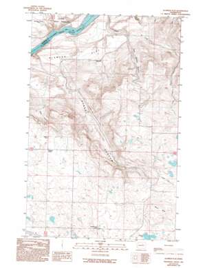
Alameda Flat Topo Map Washington
To zoom in, hover over the map of Alameda Flat
USGS Topo Quad 48119a2 - 1:24,000 scale
| Topo Map Name: | Alameda Flat |
| USGS Topo Quad ID: | 48119a2 |
| Print Size: | ca. 21 1/4" wide x 27" high |
| Southeast Coordinates: | 48° N latitude / 119.125° W longitude |
| Map Center Coordinates: | 48.0625° N latitude / 119.1875° W longitude |
| U.S. State: | WA |
| Filename: | o48119a2.jpg |
| Download Map JPG Image: | Alameda Flat topo map 1:24,000 scale |
| Map Type: | Topographic |
| Topo Series: | 7.5´ |
| Map Scale: | 1:24,000 |
| Source of Map Images: | United States Geological Survey (USGS) |
| Alternate Map Versions: |
Alameda Flat WA 1989, updated 1989 Download PDF Buy paper map Alameda Flat WA 1989, updated 1994 Download PDF Buy paper map Alameda Flat WA 2011 Download PDF Buy paper map Alameda Flat WA 2014 Download PDF Buy paper map |
1:24,000 Topo Quads surrounding Alameda Flat
> Back to 48119a1 at 1:100,000 scale
> Back to 48118a1 at 1:250,000 scale
> Back to U.S. Topo Maps home
Alameda Flat topo map: Gazetteer
Alameda Flat: Flats
Alameda Flat elevation 348m 1141′Alameda Flat: Lakes
Rattlesnake Lake elevation 738m 2421′Wilson Lake elevation 734m 2408′
Alameda Flat: Pillars
Balloon Rock elevation 781m 2562′Alameda Flat: Populated Places
Osborne Corner elevation 769m 2522′Alameda Flat: Rapids
Mah-kin Rapids elevation 290m 951′Alameda Flat: Summits
Wilson Butte elevation 830m 2723′Alameda Flat: Valleys
Buck Canyon elevation 540m 1771′Strahl Canyon elevation 400m 1312′
Twin Springs Canyon elevation 411m 1348′
Alameda Flat digital topo map on disk
Buy this Alameda Flat topo map showing relief, roads, GPS coordinates and other geographical features, as a high-resolution digital map file on DVD:


