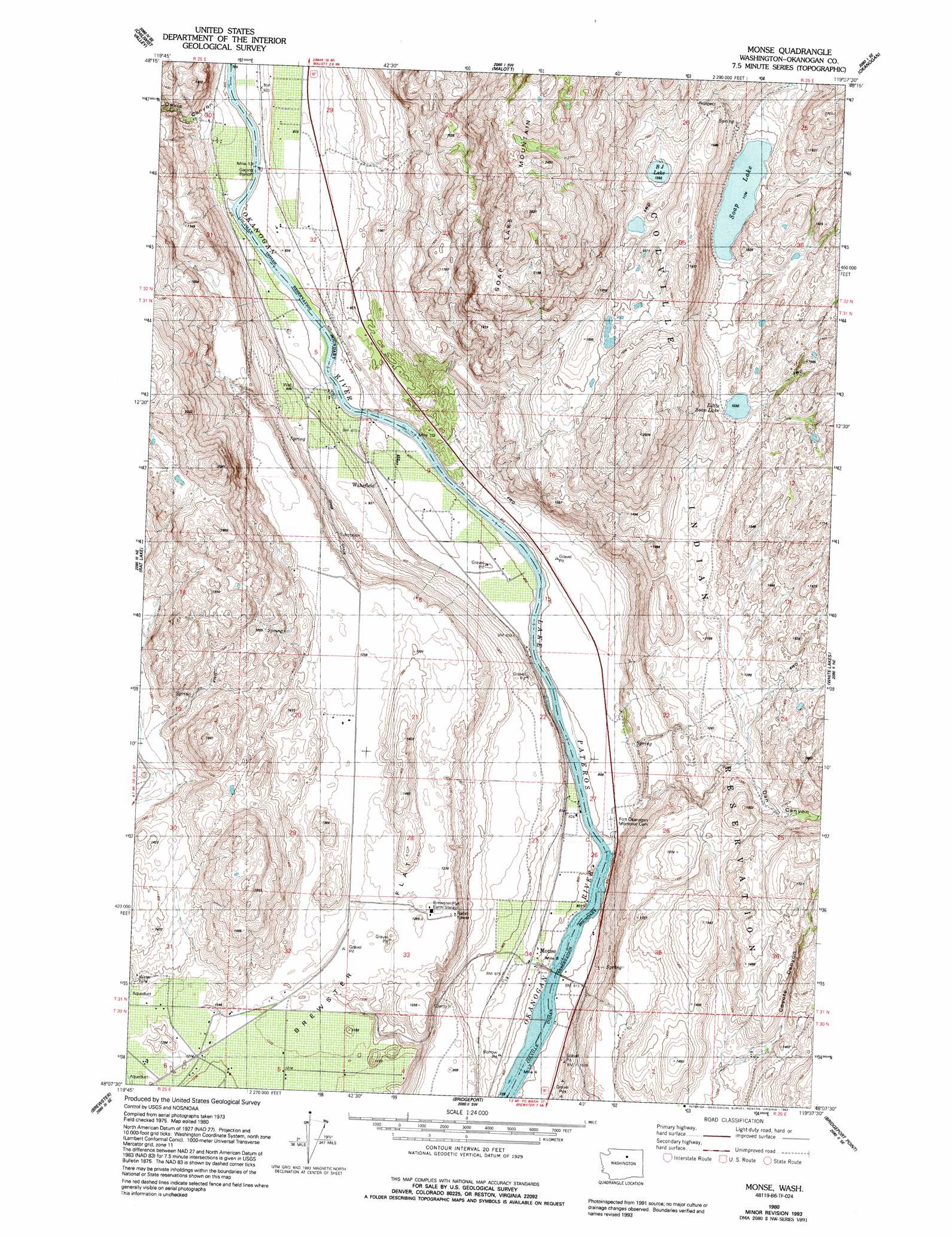
Monse Topo Map Washington
To zoom in, hover over the map of Monse
USGS Topo Quad 48119b6 - 1:24,000 scale
| Topo Map Name: | Monse |
| USGS Topo Quad ID: | 48119b6 |
| Print Size: | ca. 21 1/4" wide x 27" high |
| Southeast Coordinates: | 48.125° N latitude / 119.625° W longitude |
| Map Center Coordinates: | 48.1875° N latitude / 119.6875° W longitude |
| U.S. State: | WA |
| Filename: | o48119b6.jpg |
| Download Map JPG Image: | Monse topo map 1:24,000 scale |
| Map Type: | Topographic |
| Topo Series: | 7.5´ |
| Map Scale: | 1:24,000 |
| Source of Map Images: | United States Geological Survey (USGS) |
| Alternate Map Versions: |
Monse WA 1980, updated 1981 Download PDF Buy paper map Monse WA 1993, updated 1993 Download PDF Buy paper map Monse WA 2011 Download PDF Buy paper map Monse WA 2014 Download PDF Buy paper map |
1:24,000 Topo Quads surrounding Monse
Loup Loup Summit |
Buck Mountain |
Ruby Hill |
Omak |
The Pothole |
Thrapp Mountain |
Chiliwist Valley |
Malott |
Okanogan |
Omak Lake |
Knowton Knob |
Rat Lake |
Monse |
White Lakes |
Joe Lake |
Pateros |
Brewster |
Bridgeport |
Bridgeport Point |
Stubblefield Point |
Azwell |
Wells Dam |
Chief Joseph Dam |
Coleman Hill |
Leahy |
> Back to 48119a1 at 1:100,000 scale
> Back to 48118a1 at 1:250,000 scale
> Back to U.S. Topo Maps home
Monse topo map: Gazetteer
Monse: Dams
Crazy Rapids Reservoir Dam elevation 285m 935′Monse: Flats
Brewster Flat elevation 373m 1223′Monse: Lakes
BJ Lake elevation 426m 1397′Little Soap Lake elevation 376m 1233′
Soap Lake elevation 359m 1177′
Monse: Populated Places
Monse elevation 254m 833′Ophir elevation 247m 810′
Thompson (historical) elevation 412m 1351′
Wakefield elevation 251m 823′
Monse: Rapids
Crazy Rapids elevation 242m 793′Monse: Reservoirs
Crazy Rapids Reservoir elevation 285m 935′Monse: Valleys
Coyote Canyon elevation 380m 1246′Dan Canyon elevation 370m 1213′
Davis Canyon elevation 257m 843′
Monse digital topo map on disk
Buy this Monse topo map showing relief, roads, GPS coordinates and other geographical features, as a high-resolution digital map file on DVD: