Camp Seven Topo Map Washington
To zoom in, hover over the map of Camp Seven
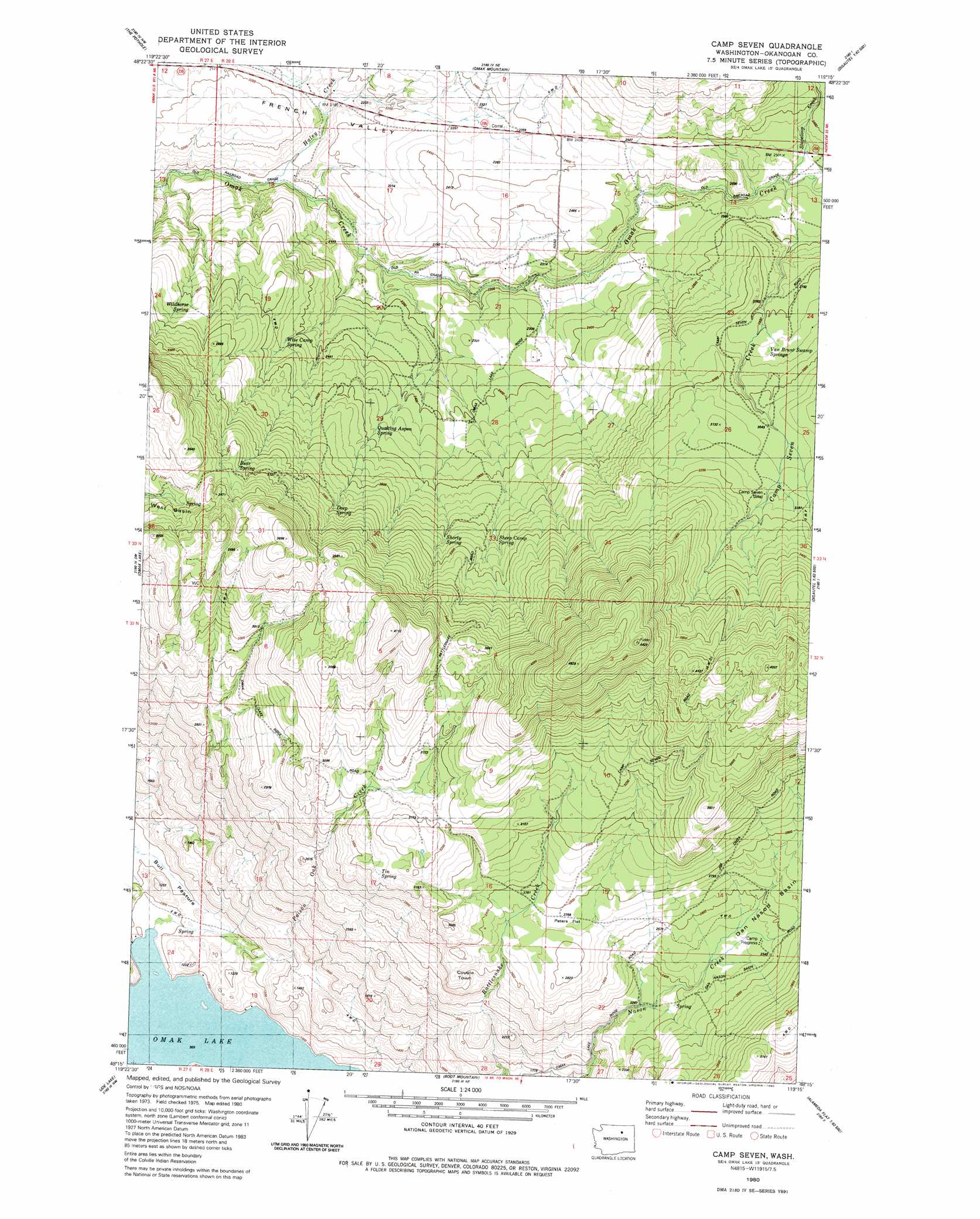
USGS Topo Quad 48119c3 - 1:24,000 scale
| Topo Map Name: | Camp Seven |
| USGS Topo Quad ID: | 48119c3 |
| Print Size: | ca. 21 1/4" wide x 27" high |
| Southeast Coordinates: | 48.25° N latitude / 119.25° W longitude |
| Map Center Coordinates: | 48.3125° N latitude / 119.3125° W longitude |
| U.S. State: | WA |
| Filename: | o48119c3.jpg |
| Download Map JPG Image: | Camp Seven topo map 1:24,000 scale |
| Map Type: | Topographic |
| Topo Series: | 7.5´ |
| Map Scale: | 1:24,000 |
| Source of Map Images: | United States Geological Survey (USGS) |
| Alternate Map Versions: |
Camp Seven WA 1980, updated 1980 Download PDF Buy paper map Camp Seven WA 2011 Download PDF Buy paper map Camp Seven WA 2014 Download PDF Buy paper map |
1:24,000 Topo Quads surrounding Camp Seven
Riverside |
Keystone |
Synarep |
Tunk Mountain |
Bailey Creek |
Omak |
The Pothole |
Omak Mountain |
Crawfish Lake |
Moses Meadows |
Okanogan |
Omak Lake |
Camp Seven |
Disautel |
Moses Mountain |
White Lakes |
Joe Lake |
Boot Mountain |
Hopkins Canyon |
Armstrong Creek |
Bridgeport Point |
Stubblefield Point |
Trefry Canyon |
Alameda Flat |
Sanderson Creek |
> Back to 48119a1 at 1:100,000 scale
> Back to 48118a1 at 1:250,000 scale
> Back to U.S. Topo Maps home
Camp Seven topo map: Gazetteer
Camp Seven: Flats
Peters Flat elevation 850m 2788′Camp Seven: Springs
Bear Spring elevation 995m 3264′Deep Spring elevation 916m 3005′
Quaking Aspen Spring elevation 777m 2549′
Sheep Camp Spring elevation 855m 2805′
Shorty Spring elevation 873m 2864′
Tin Spring elevation 940m 3083′
Van Brunt Swamp Springs elevation 871m 2857′
Wildhorse Spring elevation 804m 2637′
Wise Camp Spring elevation 747m 2450′
Camp Seven: Streams
Camp Seven Creek elevation 740m 2427′Haley Creek elevation 601m 1971′
Poison Oak Creek elevation 302m 990′
Stapaloop Creek elevation 746m 2447′
Camp Seven: Summits
Coyote Town elevation 842m 2762′Camp Seven digital topo map on disk
Buy this Camp Seven topo map showing relief, roads, GPS coordinates and other geographical features, as a high-resolution digital map file on DVD: