Aeneas Lake Topo Map Washington
To zoom in, hover over the map of Aeneas Lake
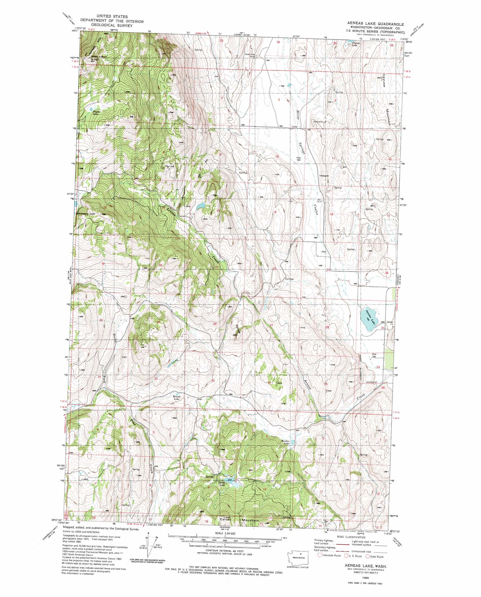
USGS Topo Quad 48119f5 - 1:24,000 scale
| Topo Map Name: | Aeneas Lake |
| USGS Topo Quad ID: | 48119f5 |
| Print Size: | ca. 21 1/4" wide x 27" high |
| Southeast Coordinates: | 48.625° N latitude / 119.5° W longitude |
| Map Center Coordinates: | 48.6875° N latitude / 119.5625° W longitude |
| U.S. State: | WA |
| Filename: | o48119f5.jpg |
| Download Map JPG Image: | Aeneas Lake topo map 1:24,000 scale |
| Map Type: | Topographic |
| Topo Series: | 7.5´ |
| Map Scale: | 1:24,000 |
| Source of Map Images: | United States Geological Survey (USGS) |
| Alternate Map Versions: |
Aeneas Lake WA 1980, updated 1981 Download PDF Buy paper map Aeneas Lake WA 2011 Download PDF Buy paper map Aeneas Lake WA 2014 Download PDF Buy paper map |
1:24,000 Topo Quads surrounding Aeneas Lake
Hurley Peak |
Nighthawk |
Bullfrog Mountain |
Oroville |
Mount Hull |
Duncan Ridge |
Loomis |
Enterprise |
Ellisforde |
Burge Mountain |
Coxit Mountain |
Blue Goat Mountain |
Aeneas Lake |
Tonasket |
Barker Mountain |
Conconully West |
Conconully East |
Riverside |
Keystone |
Synarep |
Buck Mountain |
Ruby Hill |
Omak |
The Pothole |
Omak Mountain |
> Back to 48119e1 at 1:100,000 scale
> Back to 48118a1 at 1:250,000 scale
> Back to U.S. Topo Maps home
Aeneas Lake topo map: Gazetteer
Aeneas Lake: Lakes
Aeneas Lake elevation 415m 1361′Burden Lake elevation 557m 1827′
Cayuse Lake elevation 547m 1794′
Hunter Lake elevation 1228m 4028′
Round Lake elevation 646m 2119′
Turtle Lake elevation 675m 2214′
Aeneas Lake: Mines
Silver Mountain Mine elevation 464m 1522′Aeneas Lake: Populated Places
Enterprise elevation 1076m 3530′Aeneas Lake: Summits
Aeneas Lookout elevation 1568m 5144′Aeneas Mountain elevation 1503m 4931′
Carter Mountain elevation 909m 2982′
Flatiron elevation 809m 2654′
Lemanasky Mountain elevation 1533m 5029′
Aeneas Lake: Valleys
Horse Springs Coulee elevation 417m 1368′Aeneas Lake digital topo map on disk
Buy this Aeneas Lake topo map showing relief, roads, GPS coordinates and other geographical features, as a high-resolution digital map file on DVD: