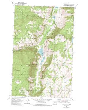
Blue Goat Mountain Topo Map Washington
To zoom in, hover over the map of Blue Goat Mountain
USGS Topo Quad 48119f6 - 1:24,000 scale
| Topo Map Name: | Blue Goat Mountain |
| USGS Topo Quad ID: | 48119f6 |
| Print Size: | ca. 21 1/4" wide x 27" high |
| Southeast Coordinates: | 48.625° N latitude / 119.625° W longitude |
| Map Center Coordinates: | 48.6875° N latitude / 119.6875° W longitude |
| U.S. State: | WA |
| Filename: | o48119f6.jpg |
| Download Map JPG Image: | Blue Goat Mountain topo map 1:24,000 scale |
| Map Type: | Topographic |
| Topo Series: | 7.5´ |
| Map Scale: | 1:24,000 |
| Source of Map Images: | United States Geological Survey (USGS) |
| Alternate Map Versions: |
Blue Goat Mtn WA 1980, updated 1981 Download PDF Buy paper map Blue Goat Mountain WA 2011 Download PDF Buy paper map Blue Goat Mountain WA 2014 Download PDF Buy paper map |
1:24,000 Topo Quads surrounding Blue Goat Mountain
> Back to 48119e1 at 1:100,000 scale
> Back to 48118a1 at 1:250,000 scale
> Back to U.S. Topo Maps home
Blue Goat Mountain topo map: Gazetteer
Blue Goat Mountain: Dams
Blue Lake Dam elevation 512m 1679′Lemansky Lake Dam elevation 1093m 3585′
Roylance Dam elevation 1022m 3353′
Sinlahekin Dam Number One elevation 478m 1568′
Sinlahekin Dam Number Three elevation 458m 1502′
Sinlahekin Dam Number Two elevation 472m 1548′
Blue Goat Mountain: Lakes
Conners Lake elevation 460m 1509′Crowder Pond elevation 1444m 4737′
Forde Lake elevation 478m 1568′
Reflection Pond elevation 473m 1551′
Blue Goat Mountain: Parks
Sinlahekin State Wildlife Recreation Area elevation 562m 1843′Sinlahekin Wildlife Recreation Area elevation 562m 1843′
Blue Goat Mountain: Reservoirs
Blue Lake elevation 512m 1679′Lemanasky Lake elevation 1093m 3585′
Lower Sinlahekin Impoundment elevation 458m 1502′
Sinlahekin Impoundment Number Two elevation 472m 1548′
Blue Goat Mountain: Streams
Blue Goat Creek elevation 882m 2893′Chilson Creek elevation 1040m 3412′
Sarsapkin Creek elevation 502m 1646′
Wickiup Creek elevation 1120m 3674′
Blue Goat Mountain: Summits
Bald Butte elevation 1518m 4980′Blue Goat Mountain elevation 1541m 5055′
Twin Peaks elevation 1605m 5265′
Blue Goat Mountain digital topo map on disk
Buy this Blue Goat Mountain topo map showing relief, roads, GPS coordinates and other geographical features, as a high-resolution digital map file on DVD:


