Mount Bonaparte Topo Map Washington
To zoom in, hover over the map of Mount Bonaparte
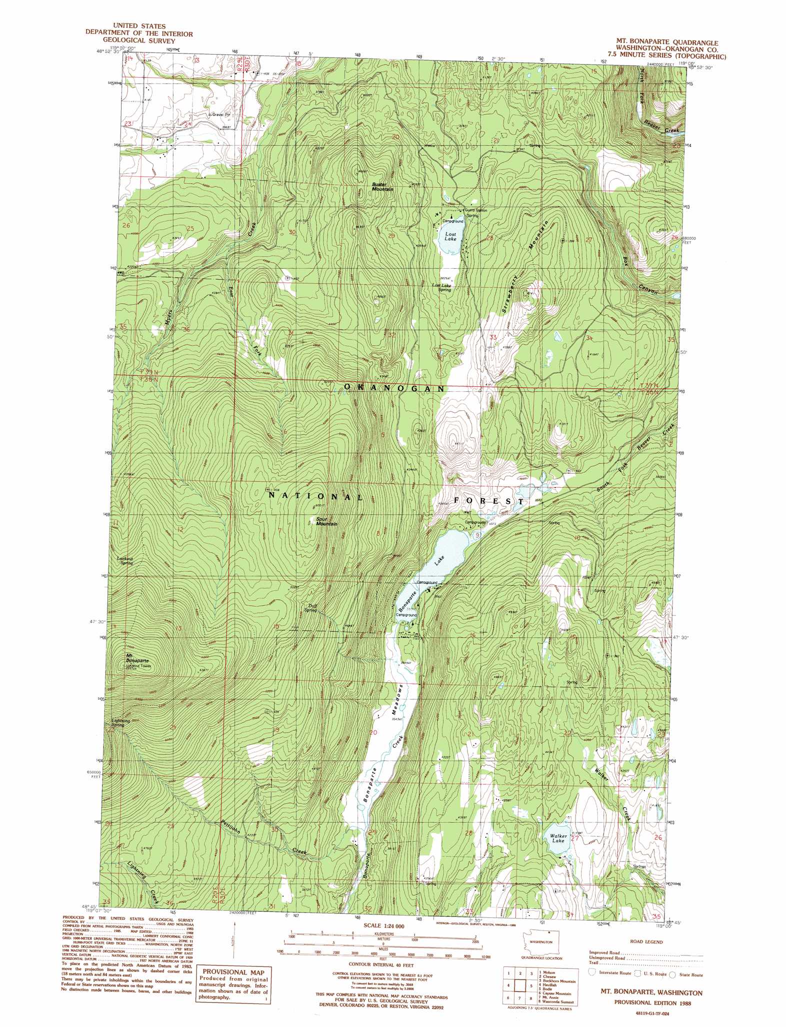
USGS Topo Quad 48119g1 - 1:24,000 scale
| Topo Map Name: | Mount Bonaparte |
| USGS Topo Quad ID: | 48119g1 |
| Print Size: | ca. 21 1/4" wide x 27" high |
| Southeast Coordinates: | 48.75° N latitude / 119° W longitude |
| Map Center Coordinates: | 48.8125° N latitude / 119.0625° W longitude |
| U.S. State: | WA |
| Filename: | o48119g1.jpg |
| Download Map JPG Image: | Mount Bonaparte topo map 1:24,000 scale |
| Map Type: | Topographic |
| Topo Series: | 7.5´ |
| Map Scale: | 1:24,000 |
| Source of Map Images: | United States Geological Survey (USGS) |
| Alternate Map Versions: |
Mt Bonaparte WA 1988, updated 1988 Download PDF Buy paper map Mount Bonaparte WA 2001, updated 2004 Download PDF Buy paper map Mount Bonaparte WA 2011 Download PDF Buy paper map Mount Bonaparte WA 2014 Download PDF Buy paper map |
| FStopo: | US Forest Service topo Mount Bonaparte is available: Download FStopo PDF Download FStopo TIF |
1:24,000 Topo Quads surrounding Mount Bonaparte
Mount Hull |
Molson |
Chesaw |
Buckhorn Mountain |
Toroda |
Burge Mountain |
Havillah |
Mount Bonaparte |
Bodie |
Bodie Mountain |
Barker Mountain |
Cayuse Mountain |
Mount Annie |
Wauconda Summit |
Storm King Mountain |
Synarep |
Tunk Mountain |
Bailey Creek |
Aeneas |
Swan Lake |
> Back to 48119e1 at 1:100,000 scale
> Back to 48118a1 at 1:250,000 scale
> Back to U.S. Topo Maps home
Mount Bonaparte topo map: Gazetteer
Mount Bonaparte: Dams
Bonaparta Lake Dam elevation 1084m 3556′Mount Bonaparte: Lakes
Lost Lake elevation 1164m 3818′Walker Lake elevation 1264m 4146′
Mount Bonaparte: Reservoirs
Bonaparte Lake elevation 1084m 3556′Mount Bonaparte: Springs
Duff Spring elevation 1481m 4858′Mount Bonaparte: Streams
East Fork Myers Creek elevation 1196m 3923′Pettijohn Creek elevation 1080m 3543′
Mount Bonaparte: Summits
Buster Mountain elevation 1413m 4635′Mount Bonaparte elevation 2212m 7257′
Spur Mountain elevation 1829m 6000′
Strawberry Mountain elevation 1437m 4714′
Mount Bonaparte: Trails
Beaver Ridge Trail elevation 1246m 4087′Bonaparte Trail elevation 1751m 5744′
South Side Trail elevation 1876m 6154′
Mount Bonaparte digital topo map on disk
Buy this Mount Bonaparte topo map showing relief, roads, GPS coordinates and other geographical features, as a high-resolution digital map file on DVD: