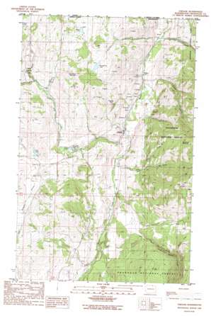
Chesaw Topo Map Washington
To zoom in, hover over the map of Chesaw
USGS Topo Quad 48119h1 - 1:24,000 scale
| Topo Map Name: | Chesaw |
| USGS Topo Quad ID: | 48119h1 |
| Print Size: | ca. 21 1/4" wide x 27" high |
| Southeast Coordinates: | 48.875° N latitude / 119° W longitude |
| Map Center Coordinates: | 48.9375° N latitude / 119.0625° W longitude |
| U.S. State: | WA |
| Filename: | o48119h1.jpg |
| Download Map JPG Image: | Chesaw topo map 1:24,000 scale |
| Map Type: | Topographic |
| Topo Series: | 7.5´ |
| Map Scale: | 1:24,000 |
| Source of Map Images: | United States Geological Survey (USGS) |
| Alternate Map Versions: |
Chesaw WA 1988, updated 1988 Download PDF Buy paper map Chesaw WA 2001, updated 2004 Download PDF Buy paper map Chesaw WA 2011 Download PDF Buy paper map Chesaw WA 2014 Download PDF Buy paper map |
| FStopo: | US Forest Service topo Chesaw is available: Download FStopo PDF Download FStopo TIF |
1:24,000 Topo Quads surrounding Chesaw
Mount Hull |
Molson |
Chesaw |
Buckhorn Mountain |
Toroda |
Burge Mountain |
Havillah |
Mount Bonaparte |
Bodie |
Bodie Mountain |
Barker Mountain |
Cayuse Mountain |
Mount Annie |
Wauconda Summit |
Storm King Mountain |
> Back to 48119e1 at 1:100,000 scale
> Back to 48118a1 at 1:250,000 scale
> Back to U.S. Topo Maps home
Chesaw topo map: Gazetteer
Chesaw: Lakes
Ads Lake elevation 1127m 3697′Mary Ann Lake elevation 1045m 3428′
Strawberry Lake elevation 1191m 3907′
Walker Lake elevation 1199m 3933′
Chesaw: Mines
Poland China Mine elevation 1154m 3786′Chesaw: Populated Places
Chesaw elevation 888m 2913′Chesaw: Ridges
Pontiac Ridge elevation 1249m 4097′Chesaw: Streams
Bolster Creek elevation 845m 2772′Ethel Creek elevation 926m 3038′
Gafvery Creek elevation 824m 2703′
Gold Creek elevation 819m 2687′
Lime Creek elevation 1030m 3379′
Mary Ann Creek elevation 889m 2916′
North Fork Gold Creek elevation 987m 3238′
North Fork Mary Ann Creek elevation 1098m 3602′
Thorp Creek elevation 863m 2831′
Chesaw: Summits
Porphyry Peak elevation 1187m 3894′Strawberry Mountain elevation 1333m 4373′
Chesaw: Valleys
Hungry Hollow elevation 1152m 3779′Chesaw digital topo map on disk
Buy this Chesaw topo map showing relief, roads, GPS coordinates and other geographical features, as a high-resolution digital map file on DVD:


