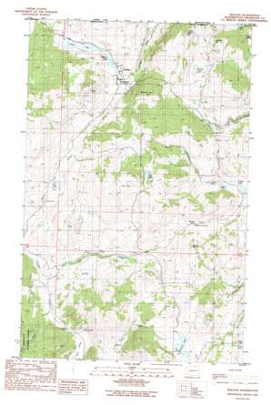
Molson Topo Map Washington
To zoom in, hover over the map of Molson
USGS Topo Quad 48119h2 - 1:24,000 scale
| Topo Map Name: | Molson |
| USGS Topo Quad ID: | 48119h2 |
| Print Size: | ca. 21 1/4" wide x 27" high |
| Southeast Coordinates: | 48.875° N latitude / 119.125° W longitude |
| Map Center Coordinates: | 48.9375° N latitude / 119.1875° W longitude |
| U.S. State: | WA |
| Filename: | o48119h2.jpg |
| Download Map JPG Image: | Molson topo map 1:24,000 scale |
| Map Type: | Topographic |
| Topo Series: | 7.5´ |
| Map Scale: | 1:24,000 |
| Source of Map Images: | United States Geological Survey (USGS) |
| Alternate Map Versions: |
Molson WA 1988, updated 1988 Download PDF Buy paper map Molson WA 2001, updated 2004 Download PDF Buy paper map Molson WA 2011 Download PDF Buy paper map Molson WA 2014 Download PDF Buy paper map |
| FStopo: | US Forest Service topo Molson is available: Download FStopo PDF Download FStopo TIF |
1:24,000 Topo Quads surrounding Molson
Oroville |
Mount Hull |
Molson |
Chesaw |
Buckhorn Mountain |
Ellisforde |
Burge Mountain |
Havillah |
Mount Bonaparte |
Bodie |
Tonasket |
Barker Mountain |
Cayuse Mountain |
Mount Annie |
Wauconda Summit |
> Back to 48119e1 at 1:100,000 scale
> Back to 48118a1 at 1:250,000 scale
> Back to U.S. Topo Maps home
Molson topo map: Gazetteer
Molson: Lakes
Alden Lake elevation 1199m 3933′Baker Lake elevation 1280m 4199′
Fields Lake elevation 1165m 3822′
Kerwin Lake elevation 1304m 4278′
Laura Lake elevation 1206m 3956′
Lindberg Lake elevation 1242m 4074′
Molson Lake elevation 1129m 3704′
Mud Lake elevation 1083m 3553′
Muskrat Lake elevation 1288m 4225′
Sanger Lake elevation 1170m 3838′
Sidley Lake elevation 1122m 3681′
Teal Lake elevation 1363m 4471′
Molson: Pillars
Hee Hee Stone elevation 1245m 4084′Molson: Populated Places
Molson elevation 1130m 3707′Molson: Streams
Dry Creek elevation 981m 3218′Molson: Summits
Block Hill elevation 1473m 4832′Hee Hee Mountain elevation 1346m 4416′
Molson Hill elevation 1359m 4458′
Molson: Valleys
Haley Canyon elevation 1007m 3303′Mud Lake Valley elevation 1019m 3343′
Molson digital topo map on disk
Buy this Molson topo map showing relief, roads, GPS coordinates and other geographical features, as a high-resolution digital map file on DVD:


