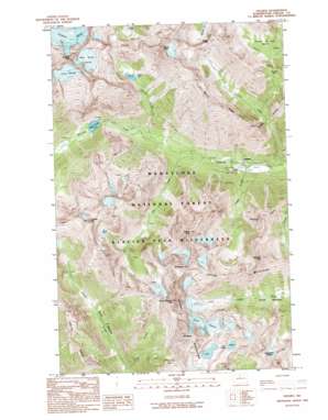
Holden Topo Map Washington
To zoom in, hover over the map of Holden
USGS Topo Quad 48120b7 - 1:24,000 scale
| Topo Map Name: | Holden |
| USGS Topo Quad ID: | 48120b7 |
| Print Size: | ca. 21 1/4" wide x 27" high |
| Southeast Coordinates: | 48.125° N latitude / 120.75° W longitude |
| Map Center Coordinates: | 48.1875° N latitude / 120.8125° W longitude |
| U.S. State: | WA |
| Filename: | o48120b7.jpg |
| Download Map JPG Image: | Holden topo map 1:24,000 scale |
| Map Type: | Topographic |
| Topo Series: | 7.5´ |
| Map Scale: | 1:24,000 |
| Source of Map Images: | United States Geological Survey (USGS) |
| Alternate Map Versions: |
Holden WA 1988, updated 1988 Download PDF Buy paper map Holden WA 1988, updated 1995 Download PDF Buy paper map Holden WA 2004, updated 2008 Download PDF Buy paper map Holden WA 2011 Download PDF Buy paper map Holden WA 2014 Download PDF Buy paper map |
| FStopo: | US Forest Service topo Holden is available: Download FStopo PDF Download FStopo TIF |
1:24,000 Topo Quads surrounding Holden
> Back to 48120a1 at 1:100,000 scale
> Back to 48120a1 at 1:250,000 scale
> Back to U.S. Topo Maps home
Holden topo map: Gazetteer
Holden: Basins
Fourth of July Basin elevation 1872m 6141′Holden: Flats
Spider Meadow elevation 1453m 4767′Holden: Forests
Entiat Ranger District elevation 2199m 7214′Holden: Gaps
Hilgard Pass elevation 2019m 6624′Tenmile Pass elevation 1980m 6496′
Holden: Glaciers
Company Glacier elevation 2091m 6860′Entiat Glacier elevation 2214m 7263′
Isella Glacier elevation 2479m 8133′
Mary Green Glacier elevation 2322m 7618′
Holden: Lakes
Hart Lake elevation 1215m 3986′Holden Lake elevation 1610m 5282′
Ice Lakes elevation 2168m 7112′
Holden: Mines
Holden Mine (historical) elevation 1105m 3625′Holden: Populated Places
Holden (historical) elevation 985m 3231′Holden: Post Offices
Holden Village Post Office (historical) elevation 1003m 3290′Holden: Ridges
Martin Ridge elevation 2324m 7624′Phelps Ridge elevation 2123m 6965′
Holden: Streams
Big Creek elevation 1033m 3389′Copper Creek elevation 975m 3198′
Holden Creek elevation 1053m 3454′
Leroy Creek elevation 1256m 4120′
Tenmile Creek elevation 978m 3208′
Holden: Summits
Bonanza Peak elevation 2849m 9347′Buckskin Mountain elevation 2457m 8061′
Copper Peak elevation 2671m 8763′
Dumbell Mountain elevation 2526m 8287′
Martin Peak elevation 2547m 8356′
Mount Fernow elevation 2767m 9078′
Mount Maude elevation 2748m 9015′
North Spectacle Butte elevation 2460m 8070′
Seven Fingered Jack elevation 2750m 9022′
South Spectacle Butte elevation 2411m 7910′
Spectacle Buttes elevation 2345m 7693′
Holden digital topo map on disk
Buy this Holden topo map showing relief, roads, GPS coordinates and other geographical features, as a high-resolution digital map file on DVD:


