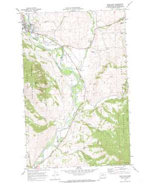
Twisp East Topo Map Washington
To zoom in, hover over the map of Twisp East
USGS Topo Quad 48120c1 - 1:24,000 scale
| Topo Map Name: | Twisp East |
| USGS Topo Quad ID: | 48120c1 |
| Print Size: | ca. 21 1/4" wide x 27" high |
| Southeast Coordinates: | 48.25° N latitude / 120° W longitude |
| Map Center Coordinates: | 48.3125° N latitude / 120.0625° W longitude |
| U.S. State: | WA |
| Filename: | o48120c1.jpg |
| Download Map JPG Image: | Twisp East topo map 1:24,000 scale |
| Map Type: | Topographic |
| Topo Series: | 7.5´ |
| Map Scale: | 1:24,000 |
| Source of Map Images: | United States Geological Survey (USGS) |
| Alternate Map Versions: |
Twisp East WA 1969, updated 1973 Download PDF Buy paper map Twisp East WA 2001, updated 2004 Download PDF Buy paper map Twisp East WA 2011 Download PDF Buy paper map Twisp East WA 2014 Download PDF Buy paper map |
| FStopo: | US Forest Service topo Twisp East is available: Download FStopo PDF Download FStopo TIF |
1:24,000 Topo Quads surrounding Twisp East
> Back to 48120a1 at 1:100,000 scale
> Back to 48120a1 at 1:250,000 scale
> Back to U.S. Topo Maps home
Twisp East topo map: Gazetteer
Twisp East: Airports
Twisp Municipal Airport elevation 480m 1574′Twisp East: Dams
Wenner Lake Number One Dam elevation 661m 2168′Twisp East: Lakes
Jim Johnson Lake elevation 562m 1843′Thurlow Lake elevation 569m 1866′
Twisp East: Mines
Minnie Mine elevation 657m 2155′Twisp East: Populated Places
Twisp elevation 499m 1637′Twisp East: Reservoirs
Wenner Lakes Number One elevation 661m 2168′Twisp East: Springs
Coffin Spring elevation 801m 2627′Wray Spring elevation 891m 2923′
Twisp East: Streams
Alder Creek elevation 451m 1479′Beaver Creek elevation 457m 1499′
Benson Creek elevation 455m 1492′
Canyon Creek elevation 447m 1466′
Frazer Creek elevation 457m 1499′
North Fork Booth Canyon Creek elevation 446m 1463′
South Fork Booth Canyon Creek elevation 573m 1879′
Twisp River elevation 480m 1574′
Twisp East: Summits
McClure Mountain elevation 1390m 4560′Mount Leecher elevation 1525m 5003′
Twisp East: Valleys
Booth Canyon elevation 463m 1519′Finley Canyon elevation 615m 2017′
Finley Canyon elevation 531m 1742′
Leecher Canyon elevation 469m 1538′
Twisp East digital topo map on disk
Buy this Twisp East topo map showing relief, roads, GPS coordinates and other geographical features, as a high-resolution digital map file on DVD:


