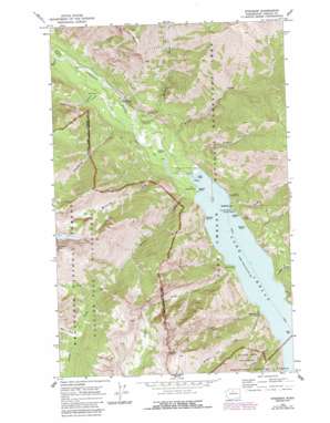
Stehekin Topo Map Washington
To zoom in, hover over the map of Stehekin
USGS Topo Quad 48120c6 - 1:24,000 scale
| Topo Map Name: | Stehekin |
| USGS Topo Quad ID: | 48120c6 |
| Print Size: | ca. 21 1/4" wide x 27" high |
| Southeast Coordinates: | 48.25° N latitude / 120.625° W longitude |
| Map Center Coordinates: | 48.3125° N latitude / 120.6875° W longitude |
| U.S. State: | WA |
| Filename: | o48120c6.jpg |
| Download Map JPG Image: | Stehekin topo map 1:24,000 scale |
| Map Type: | Topographic |
| Topo Series: | 7.5´ |
| Map Scale: | 1:24,000 |
| Source of Map Images: | United States Geological Survey (USGS) |
| Alternate Map Versions: |
Stehekin WA 1969, updated 1973 Download PDF Buy paper map Stehekin WA 1969, updated 1980 Download PDF Buy paper map Stehekin WA 1969, updated 1987 Download PDF Buy paper map Stehekin WA 2011 Download PDF Buy paper map Stehekin WA 2014 Download PDF Buy paper map |
| FStopo: | US Forest Service topo Stehekin is available: Download FStopo PDF Download FStopo TIF |
1:24,000 Topo Quads surrounding Stehekin
> Back to 48120a1 at 1:100,000 scale
> Back to 48120a1 at 1:250,000 scale
> Back to U.S. Topo Maps home
Stehekin topo map: Gazetteer
Stehekin: Airports
Stehekin State Airport elevation 371m 1217′Stehekin: Capes
Adams Point elevation 346m 1135′Purple Point elevation 342m 1122′
Weaver Point elevation 336m 1102′
Stehekin: Cliffs
Painted Rocks elevation 336m 1102′Stehekin: Falls
Bridal Veil Falls elevation 447m 1466′Rainbow Falls elevation 548m 1797′
Stehekin: Flats
McGregor Meadows elevation 390m 1279′Stehekin: Parks
Lake Chelan National Recreation Area elevation 1514m 4967′Stehekin: Populated Places
Stehekin elevation 350m 1148′Stehekin: Streams
Battalion Creek elevation 386m 1266′Bird Creek elevation 1262m 4140′
Blackberry Creek elevation 352m 1154′
Boulder Creek elevation 343m 1125′
Bridal Veil Creek elevation 341m 1118′
Canyon Creek elevation 338m 1108′
Castle Creek elevation 336m 1102′
Company Creek elevation 362m 1187′
Devore Creek elevation 336m 1102′
Flick Creek elevation 357m 1171′
Fourmile Creek elevation 338m 1108′
Hazard Creek elevation 346m 1135′
Little Boulder Creek elevation 336m 1102′
Margerum Creek elevation 342m 1122′
Onemile Creek elevation 336m 1102′
Purple Creek elevation 341m 1118′
Rainbow Creek elevation 346m 1135′
Riddle Creek elevation 336m 1102′
Stehekin River elevation 336m 1102′
West Fork Devore Creek elevation 1415m 4642′
Stehekin: Summits
Castle Rock elevation 2441m 8008′Rainbow Mountain elevation 1788m 5866′
Stehekin digital topo map on disk
Buy this Stehekin topo map showing relief, roads, GPS coordinates and other geographical features, as a high-resolution digital map file on DVD:


