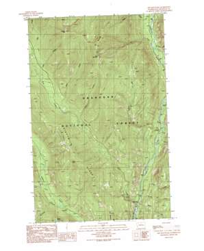
Doe Mountain Topo Map Washington
To zoom in, hover over the map of Doe Mountain
USGS Topo Quad 48120f2 - 1:24,000 scale
| Topo Map Name: | Doe Mountain |
| USGS Topo Quad ID: | 48120f2 |
| Print Size: | ca. 21 1/4" wide x 27" high |
| Southeast Coordinates: | 48.625° N latitude / 120.125° W longitude |
| Map Center Coordinates: | 48.6875° N latitude / 120.1875° W longitude |
| U.S. State: | WA |
| Filename: | o48120f2.jpg |
| Download Map JPG Image: | Doe Mountain topo map 1:24,000 scale |
| Map Type: | Topographic |
| Topo Series: | 7.5´ |
| Map Scale: | 1:24,000 |
| Source of Map Images: | United States Geological Survey (USGS) |
| Alternate Map Versions: |
Doe Mountain WA 1991, updated 1991 Download PDF Buy paper map Doe Mountain WA 2002, updated 2006 Download PDF Buy paper map Doe Mountain WA 2011 Download PDF Buy paper map Doe Mountain WA 2014 Download PDF Buy paper map |
| FStopo: | US Forest Service topo Doe Mountain is available: Download FStopo PDF Download FStopo TIF |
1:24,000 Topo Quads surrounding Doe Mountain
> Back to 48120e1 at 1:100,000 scale
> Back to 48120a1 at 1:250,000 scale
> Back to U.S. Topo Maps home
Doe Mountain topo map: Gazetteer
Doe Mountain: Falls
Falls Creek Falls elevation 809m 2654′Doe Mountain: Ridges
Eightmile Ridge elevation 1591m 5219′Doe Mountain: Streams
Alex Creek elevation 1150m 3772′Brevicomis Creek elevation 700m 2296′
Buck Creek elevation 752m 2467′
Bud Creek elevation 1209m 3966′
Butte Creek elevation 660m 2165′
Deer Creek elevation 859m 2818′
Dodd Creek elevation 765m 2509′
Doe Creek elevation 684m 2244′
Falls Creek elevation 660m 2165′
Junior Creek elevation 698m 2290′
Lamb Creek elevation 1304m 4278′
Leroy Creek elevation 672m 2204′
No Snake Creek elevation 752m 2467′
Ortell Creek elevation 896m 2939′
Sherwood Creek elevation 829m 2719′
Spring Creek elevation 684m 2244′
Doe Mountain: Summits
Doe Mountain elevation 2174m 7132′Farewell Peak elevation 2260m 7414′
Ike Mountain elevation 2186m 7171′
Lamb Butte elevation 1685m 5528′
Paul Mountain elevation 1273m 4176′
Doe Mountain digital topo map on disk
Buy this Doe Mountain topo map showing relief, roads, GPS coordinates and other geographical features, as a high-resolution digital map file on DVD:


