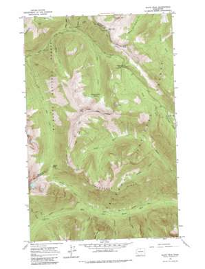
Slate Peak Topo Map Washington
To zoom in, hover over the map of Slate Peak
USGS Topo Quad 48120f6 - 1:24,000 scale
| Topo Map Name: | Slate Peak |
| USGS Topo Quad ID: | 48120f6 |
| Print Size: | ca. 21 1/4" wide x 27" high |
| Southeast Coordinates: | 48.625° N latitude / 120.625° W longitude |
| Map Center Coordinates: | 48.6875° N latitude / 120.6875° W longitude |
| U.S. State: | WA |
| Filename: | o48120f6.jpg |
| Download Map JPG Image: | Slate Peak topo map 1:24,000 scale |
| Map Type: | Topographic |
| Topo Series: | 7.5´ |
| Map Scale: | 1:24,000 |
| Source of Map Images: | United States Geological Survey (USGS) |
| Alternate Map Versions: |
Slate Peak WA 1963, updated 1964 Download PDF Buy paper map Slate Peak WA 1963, updated 1975 Download PDF Buy paper map Slate Peak WA 1963, updated 1984 Download PDF Buy paper map Slate Peak WA 1963, updated 1984 Download PDF Buy paper map Slate Peak WA 2002, updated 2006 Download PDF Buy paper map Slate Peak WA 2011 Download PDF Buy paper map Slate Peak WA 2014 Download PDF Buy paper map |
| FStopo: | US Forest Service topo Slate Peak is available: Download FStopo PDF Download FStopo TIF |
1:24,000 Topo Quads surrounding Slate Peak
> Back to 48120e1 at 1:100,000 scale
> Back to 48120a1 at 1:250,000 scale
> Back to U.S. Topo Maps home
Slate Peak topo map: Gazetteer
Slate Peak: Areas
Horse Heaven elevation 1384m 4540′Slate Peak: Basins
Ninetynine Basin elevation 1763m 5784′Slate Peak: Gaps
Glacier Pass elevation 1692m 5551′Grasshopper Pass elevation 2053m 6735′
Harts Pass elevation 1887m 6190′
Slate Pass elevation 2120m 6955′
Slate Peak: Mines
Brown Bear Mine elevation 1910m 6266′Goat Mine elevation 1284m 4212′
Illinois Mine elevation 1735m 5692′
Whistler Mine elevation 1350m 4429′
Slate Peak: Ridges
Handcock Ridge elevation 2174m 7132′Slate Peak: Streams
Arralde Creek elevation 1234m 4048′Brush Creek elevation 1143m 3750′
Cataract Creek elevation 1082m 3549′
Dicky Creek elevation 1230m 4035′
Jet Creek elevation 1305m 4281′
Leap Creek elevation 1024m 3359′
Needle Creek elevation 1047m 3435′
North Fork Trout Creek elevation 1308m 4291′
Rattlesnake Creek elevation 1190m 3904′
South Fork Trout Creek elevation 1307m 4288′
Tower Creek elevation 1122m 3681′
Slate Peak: Summits
Haystack Mountain elevation 2224m 7296′Slate Peak elevation 2247m 7372′
Tatie Peak elevation 2241m 7352′
Slate Peak: Trails
West Fork Methow Trail elevation 1083m 3553′Slate Peak digital topo map on disk
Buy this Slate Peak topo map showing relief, roads, GPS coordinates and other geographical features, as a high-resolution digital map file on DVD:


