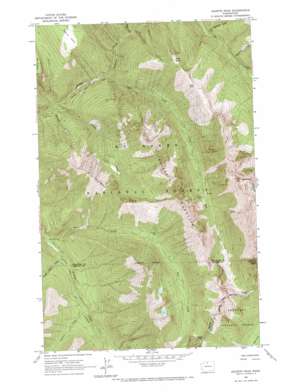
Azurite Peak Topo Map Washington
To zoom in, hover over the map of Azurite Peak
USGS Topo Quad 48120f7 - 1:24,000 scale
| Topo Map Name: | Azurite Peak |
| USGS Topo Quad ID: | 48120f7 |
| Print Size: | ca. 21 1/4" wide x 27" high |
| Southeast Coordinates: | 48.625° N latitude / 120.75° W longitude |
| Map Center Coordinates: | 48.6875° N latitude / 120.8125° W longitude |
| U.S. State: | WA |
| Filename: | o48120f7.jpg |
| Download Map JPG Image: | Azurite Peak topo map 1:24,000 scale |
| Map Type: | Topographic |
| Topo Series: | 7.5´ |
| Map Scale: | 1:24,000 |
| Source of Map Images: | United States Geological Survey (USGS) |
| Alternate Map Versions: |
Azurite Peak WA 1963, updated 1964 Download PDF Buy paper map Azurite Peak WA 1963, updated 1969 Download PDF Buy paper map Azurite Peak WA 2002, updated 2006 Download PDF Buy paper map Azurite Peak WA 2011 Download PDF Buy paper map Azurite Peak WA 2014 Download PDF Buy paper map |
| FStopo: | US Forest Service topo Azurite Peak is available: Download FStopo PDF Download FStopo TIF |
1:24,000 Topo Quads surrounding Azurite Peak
> Back to 48120e1 at 1:100,000 scale
> Back to 48120a1 at 1:250,000 scale
> Back to U.S. Topo Maps home
Azurite Peak topo map: Gazetteer
Azurite Peak: Capes
Cady Point elevation 1988m 6522′Azurite Peak: Flats
Devils Park elevation 1815m 5954′Azurite Peak: Gaps
Azurite Pass elevation 2039m 6689′Cady Pass elevation 1815m 5954′
Mebee Pass elevation 1973m 6473′
Rowley Chasm elevation 1372m 4501′
Azurite Peak: Mines
Azurite Mine elevation 1358m 4455′Gold Hill Mine elevation 1440m 4724′
North American Mine elevation 1303m 4274′
Azurite Peak: Populated Places
Cedar Crossing elevation 812m 2664′Azurite Peak: Ridges
McKay Ridge elevation 1971m 6466′Azurite Peak: Streams
Boulder Creek elevation 671m 2201′Cabinet Creek elevation 955m 3133′
County Line Creek elevation 805m 2641′
East Creek elevation 762m 2500′
Friday Creek elevation 827m 2713′
Holmes Creek elevation 656m 2152′
Mill Creek elevation 756m 2480′
Nickol Creek elevation 668m 2191′
Rockefeller Creek elevation 1049m 3441′
Skeleton Creek elevation 989m 3244′
South Fork Slate Creek elevation 1093m 3585′
Azurite Peak: Summits
Azurite Peak elevation 2537m 8323′Majestic Mountain elevation 2261m 7417′
Mount Ballard elevation 2512m 8241′
Azurite Peak: Trails
Mill Creek Trail elevation 1282m 4206′Azurite Peak digital topo map on disk
Buy this Azurite Peak topo map showing relief, roads, GPS coordinates and other geographical features, as a high-resolution digital map file on DVD:


