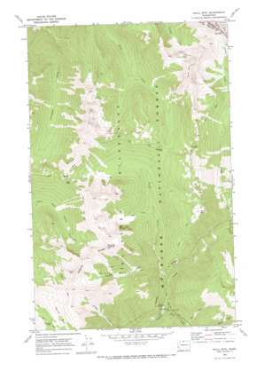
Shull Mountain Topo Map Washington
To zoom in, hover over the map of Shull Mountain
USGS Topo Quad 48120g7 - 1:24,000 scale
| Topo Map Name: | Shull Mountain |
| USGS Topo Quad ID: | 48120g7 |
| Print Size: | ca. 21 1/4" wide x 27" high |
| Southeast Coordinates: | 48.75° N latitude / 120.75° W longitude |
| Map Center Coordinates: | 48.8125° N latitude / 120.8125° W longitude |
| U.S. State: | WA |
| Filename: | o48120g7.jpg |
| Download Map JPG Image: | Shull Mountain topo map 1:24,000 scale |
| Map Type: | Topographic |
| Topo Series: | 7.5´ |
| Map Scale: | 1:24,000 |
| Source of Map Images: | United States Geological Survey (USGS) |
| Alternate Map Versions: |
Shull Mtn. WA 1969, updated 1973 Download PDF Buy paper map Shull Mountain WA 2002, updated 2006 Download PDF Buy paper map Shull Mountain WA 2011 Download PDF Buy paper map Shull Mountain WA 2014 Download PDF Buy paper map |
| FStopo: | US Forest Service topo Shull Mountain is available: Download FStopo PDF Download FStopo TIF |
1:24,000 Topo Quads surrounding Shull Mountain
> Back to 48120e1 at 1:100,000 scale
> Back to 48120a1 at 1:250,000 scale
> Back to U.S. Topo Maps home
Shull Mountain topo map: Gazetteer
Shull Mountain: Basins
Hells Basin elevation 1403m 4603′Shull Mountain: Gaps
Deception Pass elevation 1618m 5308′Devils Pass elevation 1841m 6040′
Rock Pass elevation 1982m 6502′
Sky Pilot Pass elevation 1926m 6318′
Shull Mountain: Lakes
Shull Lake elevation 2073m 6801′Shull Mountain: Populated Places
Anacortes Crossing elevation 2086m 6843′Shull Mountain: Ridges
Jackita Ridge elevation 2134m 7001′Shull Mountain: Streams
Barron Creek elevation 1190m 3904′Cascade Creek elevation 1009m 3310′
Elk Creek elevation 1265m 4150′
Lime Creek elevation 956m 3136′
North Fork Canyon Creek elevation 902m 2959′
Slate Creek elevation 864m 2834′
Shull Mountain: Summits
Center Mountain elevation 2006m 6581′Shull Mountain elevation 2381m 7811′
Shull Mountain digital topo map on disk
Buy this Shull Mountain topo map showing relief, roads, GPS coordinates and other geographical features, as a high-resolution digital map file on DVD:


