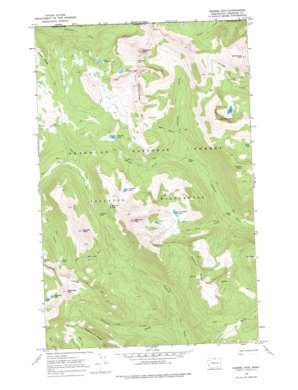
Remmel Mountain Topo Map Washington
To zoom in, hover over the map of Remmel Mountain
USGS Topo Quad 48120h2 - 1:24,000 scale
| Topo Map Name: | Remmel Mountain |
| USGS Topo Quad ID: | 48120h2 |
| Print Size: | ca. 21 1/4" wide x 27" high |
| Southeast Coordinates: | 48.875° N latitude / 120.125° W longitude |
| Map Center Coordinates: | 48.9375° N latitude / 120.1875° W longitude |
| U.S. State: | WA |
| Filename: | o48120h2.jpg |
| Download Map JPG Image: | Remmel Mountain topo map 1:24,000 scale |
| Map Type: | Topographic |
| Topo Series: | 7.5´ |
| Map Scale: | 1:24,000 |
| Source of Map Images: | United States Geological Survey (USGS) |
| Alternate Map Versions: |
Remmel Mtn. WA 1969, updated 1973 Download PDF Buy paper map Remmel Mtn. WA 1969, updated 1978 Download PDF Buy paper map Remmel Mountain WA 2002, updated 2006 Download PDF Buy paper map Remmel Mountain WA 2011 Download PDF Buy paper map Remmel Mountain WA 2014 Download PDF Buy paper map |
| FStopo: | US Forest Service topo Remmel Mountain is available: Download FStopo PDF Download FStopo TIF |
1:24,000 Topo Quads surrounding Remmel Mountain
> Back to 48120e1 at 1:100,000 scale
> Back to 48120a1 at 1:250,000 scale
> Back to U.S. Topo Maps home
Remmel Mountain topo map: Gazetteer
Remmel Mountain: Gaps
Andrew Pass elevation 2038m 6686′Apex Pass elevation 2224m 7296′
Cathedral Pass elevation 2320m 7611′
Crazy Man Pass elevation 2277m 7470′
Remmel Mountain: Lakes
Airview Lake elevation 2206m 7237′Cathedral Lakes elevation 2173m 7129′
Cornwell Lake elevation 2119m 6952′
Four Point Lake elevation 2089m 6853′
Glory Lake elevation 2034m 6673′
Lower Cathedral Lake elevation 2085m 6840′
Peepsight Lake elevation 2158m 7080′
Remmel Lake elevation 2097m 6879′
Rock Lake elevation 2182m 7158′
Tungsten Lake elevation 2154m 7066′
Upper Cathedral Lake elevation 2251m 7385′
Remmel Mountain: Ridges
Border Ridge elevation 2177m 7142′Coleman Ridge elevation 2305m 7562′
Remmel Mountain: Streams
Cathedral Creek elevation 1715m 5626′Four Point Creek elevation 1595m 5232′
Hazel Creek elevation 1845m 6053′
Peepsight Creek elevation 1547m 5075′
Remmel Creek elevation 1720m 5643′
Remmel Mountain: Summits
Amphitheater Mountain elevation 2458m 8064′Andrew Peak elevation 2518m 8261′
Apex Mountain elevation 2529m 8297′
Cal Peak elevation 2274m 7460′
Cathedral Peak elevation 2461m 8074′
Peepsight Mountain elevation 2459m 8067′
Remmel Mountain elevation 2636m 8648′
Saddle Peak elevation 2320m 7611′
Wolframite Mountain elevation 2440m 8005′
Remmel Mountain digital topo map on disk
Buy this Remmel Mountain topo map showing relief, roads, GPS coordinates and other geographical features, as a high-resolution digital map file on DVD:


