Frosty Creek Topo Map Washington
To zoom in, hover over the map of Frosty Creek
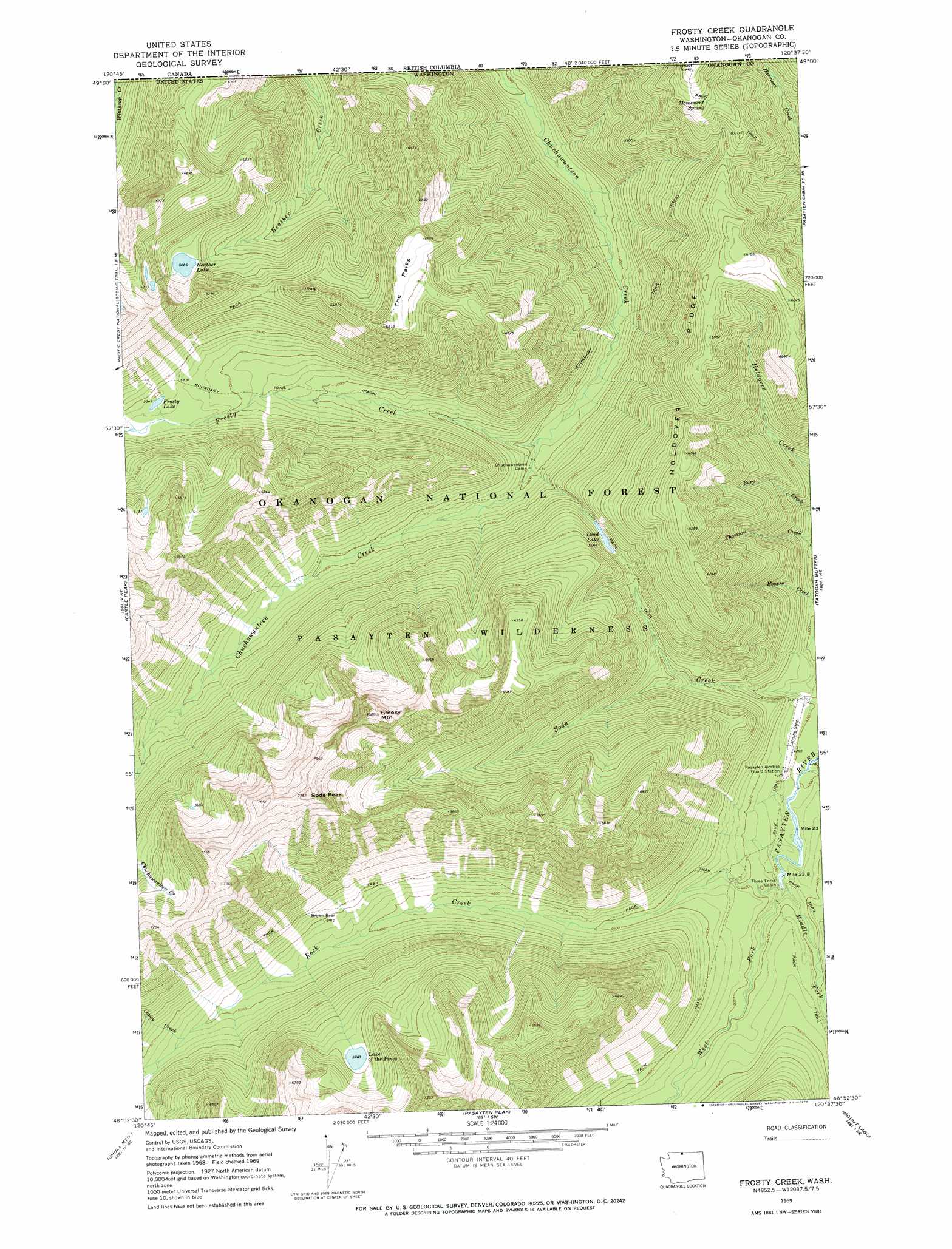
USGS Topo Quad 48120h6 - 1:24,000 scale
| Topo Map Name: | Frosty Creek |
| USGS Topo Quad ID: | 48120h6 |
| Print Size: | ca. 21 1/4" wide x 27" high |
| Southeast Coordinates: | 48.875° N latitude / 120.625° W longitude |
| Map Center Coordinates: | 48.9375° N latitude / 120.6875° W longitude |
| U.S. State: | WA |
| Filename: | o48120h6.jpg |
| Download Map JPG Image: | Frosty Creek topo map 1:24,000 scale |
| Map Type: | Topographic |
| Topo Series: | 7.5´ |
| Map Scale: | 1:24,000 |
| Source of Map Images: | United States Geological Survey (USGS) |
| Alternate Map Versions: |
Frosty Creek WA 1969, updated 1973 Download PDF Buy paper map Frosty Creek WA 2002, updated 2006 Download PDF Buy paper map Frosty Creek WA 2011 Download PDF Buy paper map Frosty Creek WA 2014 Download PDF Buy paper map |
| FStopo: | US Forest Service topo Frosty Creek is available: Download FStopo PDF Download FStopo TIF |
1:24,000 Topo Quads surrounding Frosty Creek
Skagit Peak |
Castle Peak |
Frosty Creek |
Tatoosh Buttes |
Ashnola Mountain |
Jack Mountain |
Shull Mountain |
Pasayten Peak |
Mount Lago |
Lost Peak |
Crater Mountain |
Azurite Peak |
Slate Peak |
Robinson Mountain |
Mcleod Mountain |
> Back to 48120e1 at 1:100,000 scale
> Back to 48120a1 at 1:250,000 scale
> Back to U.S. Topo Maps home
Frosty Creek topo map: Gazetteer
Frosty Creek: Airports
Pasayten-US Forest Service Airfield elevation 1300m 4265′Frosty Creek: Flats
The Parks elevation 1965m 6446′Frosty Creek: Lakes
Dead Lake elevation 1546m 5072′Frosty Lake elevation 1631m 5351′
Heather Lake elevation 1728m 5669′
Lake of the Pines elevation 1764m 5787′
Frosty Creek: Ridges
Holdover Ridge elevation 1865m 6118′Frosty Creek: Springs
Monument Spring elevation 1879m 6164′Frosty Creek: Streams
Coney Creek elevation 1544m 5065′Frosty Creek elevation 1387m 4550′
Lease Creek elevation 1279m 4196′
Middle Fork Pasayten River elevation 1305m 4281′
Rock Creek elevation 1305m 4281′
Snehumption Creek elevation 1710m 5610′
West Fork Pasayten River elevation 1306m 4284′
Frosty Creek: Summits
Smoky Mountain elevation 2303m 7555′Soda Peak elevation 2359m 7739′
Frosty Creek digital topo map on disk
Buy this Frosty Creek topo map showing relief, roads, GPS coordinates and other geographical features, as a high-resolution digital map file on DVD: