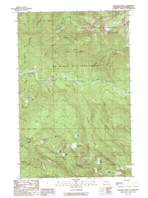
Mallardy Ridge Topo Map Washington
To zoom in, hover over the map of Mallardy Ridge
USGS Topo Quad 48121a6 - 1:24,000 scale
| Topo Map Name: | Mallardy Ridge |
| USGS Topo Quad ID: | 48121a6 |
| Print Size: | ca. 21 1/4" wide x 27" high |
| Southeast Coordinates: | 48° N latitude / 121.625° W longitude |
| Map Center Coordinates: | 48.0625° N latitude / 121.6875° W longitude |
| U.S. State: | WA |
| Filename: | o48121a6.jpg |
| Download Map JPG Image: | Mallardy Ridge topo map 1:24,000 scale |
| Map Type: | Topographic |
| Topo Series: | 7.5´ |
| Map Scale: | 1:24,000 |
| Source of Map Images: | United States Geological Survey (USGS) |
| Alternate Map Versions: |
Mallardy Ridge WA 1989, updated 1989 Download PDF Buy paper map Mallardy Ridge WA 2011 Download PDF Buy paper map Mallardy Ridge WA 2014 Download PDF Buy paper map |
| FStopo: | US Forest Service topo Mallardy Ridge is available: Download FStopo PDF Download FStopo TIF |
1:24,000 Topo Quads surrounding Mallardy Ridge
> Back to 48121a1 at 1:100,000 scale
> Back to 48120a1 at 1:250,000 scale
> Back to U.S. Topo Maps home
Mallardy Ridge topo map: Gazetteer
Mallardy Ridge: Areas
Long Creek Research Natural Area elevation 615m 2017′Mallardy Ridge: Basins
Gold Basin elevation 330m 1082′Mallardy Ridge: Falls
Twin Falls elevation 714m 2342′Mallardy Ridge: Gaps
Granite Pass elevation 1040m 3412′Mallardy Ridge: Lakes
Ashland Lakes elevation 866m 2841′Bald Mountain Lake elevation 1104m 3622′
Bear Lake elevation 847m 2778′
Beaver Plant Lake elevation 861m 2824′
Boardman Lake elevation 911m 2988′
Canyon Lake elevation 828m 2716′
Clear Lake elevation 1031m 3382′
Clear Lake elevation 726m 2381′
Cutthroat Lakes elevation 1255m 4117′
East Boardman Lake elevation 1026m 3366′
Island Lake elevation 1080m 3543′
Lake Evan elevation 843m 2765′
Lost Lake elevation 719m 2358′
Twin Falls Lake elevation 681m 2234′
Mallardy Ridge: Parks
Gold Basin Recreation Area elevation 331m 1085′Mallardy Ridge: Ridges
Gordon Ridge elevation 980m 3215′Mallardy Ridge elevation 1078m 3536′
Wiley Ridge elevation 1138m 3733′
Mallardy Ridge: Streams
Bear Creek elevation 424m 1391′Black Creek elevation 343m 1125′
Blackjack Creek elevation 416m 1364′
Boardman Creek elevation 390m 1279′
Eldredge Creek elevation 399m 1309′
Gordon Creek elevation 382m 1253′
Hempel Creek elevation 319m 1046′
Long Creek elevation 378m 1240′
Mallardy Creek elevation 392m 1286′
Schweitzer Creek elevation 373m 1223′
Wiley Creek elevation 357m 1171′
Wisconsin Creek elevation 346m 1135′
Mallardy Ridge digital topo map on disk
Buy this Mallardy Ridge topo map showing relief, roads, GPS coordinates and other geographical features, as a high-resolution digital map file on DVD:


