Mount Higgins Topo Map Washington
To zoom in, hover over the map of Mount Higgins
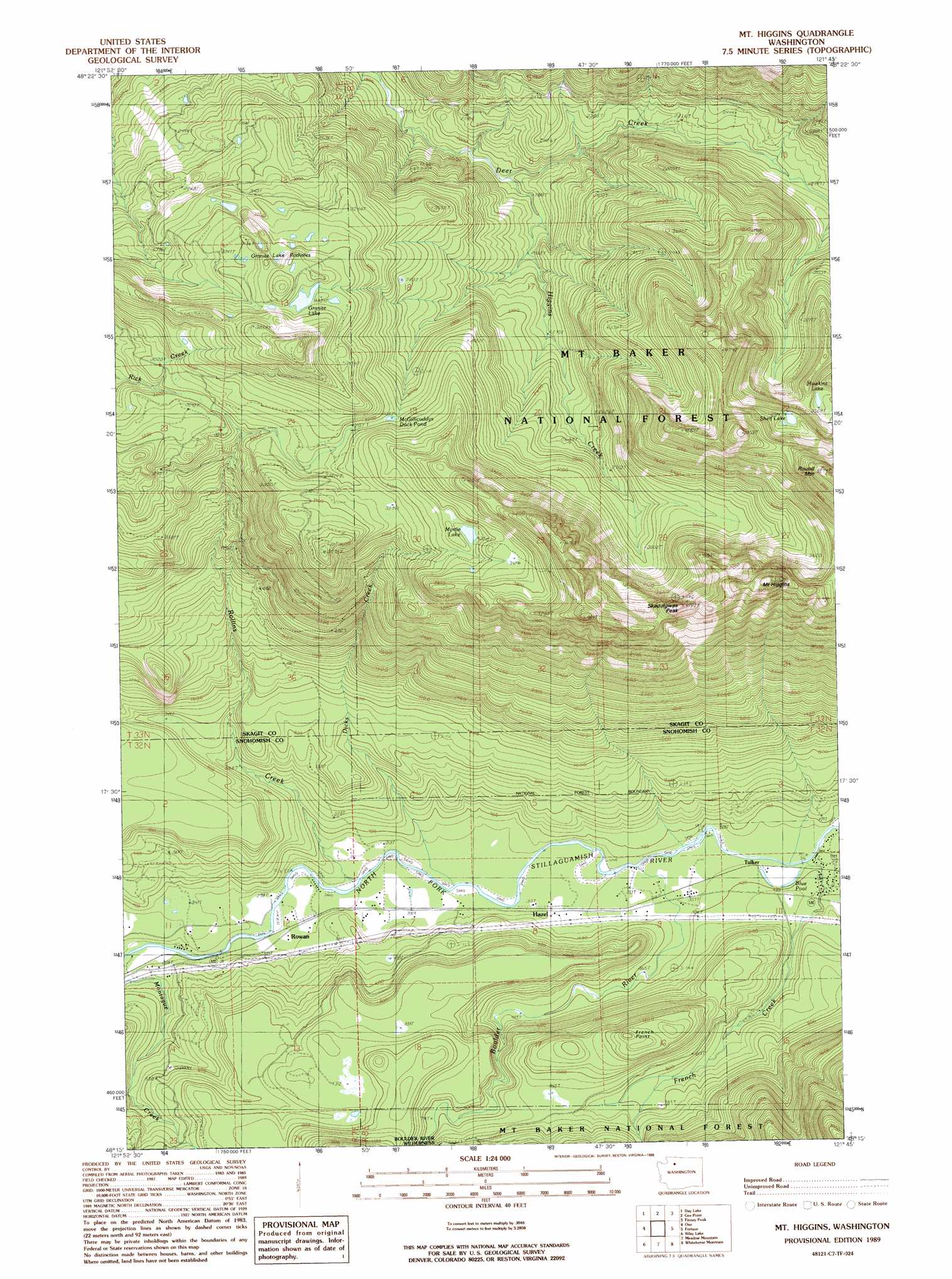
USGS Topo Quad 48121c7 - 1:24,000 scale
| Topo Map Name: | Mount Higgins |
| USGS Topo Quad ID: | 48121c7 |
| Print Size: | ca. 21 1/4" wide x 27" high |
| Southeast Coordinates: | 48.25° N latitude / 121.75° W longitude |
| Map Center Coordinates: | 48.3125° N latitude / 121.8125° W longitude |
| U.S. State: | WA |
| Filename: | o48121c7.jpg |
| Download Map JPG Image: | Mount Higgins topo map 1:24,000 scale |
| Map Type: | Topographic |
| Topo Series: | 7.5´ |
| Map Scale: | 1:24,000 |
| Source of Map Images: | United States Geological Survey (USGS) |
| Alternate Map Versions: |
Mt Higgins WA 1989, updated 1989 Download PDF Buy paper map Mount Higgins WA 2011 Download PDF Buy paper map Mount Higgins WA 2014 Download PDF Buy paper map |
| FStopo: | US Forest Service topo Mount Higgins is available: Download FStopo PDF Download FStopo TIF |
1:24,000 Topo Quads surrounding Mount Higgins
Lyman |
Hamilton |
Grandy Lake |
Lake Shannon |
Sauk Mountain |
Haystack Mountain |
Day Lake |
Gee Point |
Finney Peak |
Rockport |
Stimson Hill |
Oso |
Mount Higgins |
Fortson |
Darrington |
Arlington East |
Riley Lake |
Meadow Mountain |
Whitehorse Mountain |
Helena Ridge |
Lake Stevens |
Granite Falls |
Verlot |
Mallardy Ridge |
Silverton |
> Back to 48121a1 at 1:100,000 scale
> Back to 48120a1 at 1:250,000 scale
> Back to U.S. Topo Maps home
Mount Higgins topo map: Gazetteer
Mount Higgins: Capes
French Point elevation 420m 1377′Mount Higgins: Lakes
Blue Pool elevation 110m 360′French Creek Pond elevation 279m 915′
Granite Lake elevation 1073m 3520′
Granite Lake Potholes elevation 1046m 3431′
Hawkins Lake elevation 1082m 3549′
McGillicuddys Duck Pond elevation 961m 3152′
Myrtle Lake elevation 1071m 3513′
Shelf Lake elevation 1226m 4022′
Mount Higgins: Populated Places
Hazel elevation 90m 295′Rowan elevation 74m 242′
Tulker elevation 111m 364′
Mount Higgins: Streams
Boulder River elevation 96m 314′Dicks Creek elevation 91m 298′
French Creek elevation 107m 351′
Higgins Creek elevation 602m 1975′
Rollins Creek elevation 86m 282′
Mount Higgins: Summits
Mount Higgins elevation 1535m 5036′Round Mountain elevation 1616m 5301′
Skadulgwas Peak elevation 1485m 4872′
Mount Higgins digital topo map on disk
Buy this Mount Higgins topo map showing relief, roads, GPS coordinates and other geographical features, as a high-resolution digital map file on DVD: