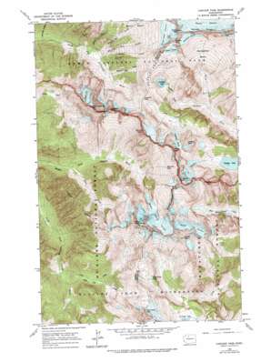
Cascade Pass Topo Map Washington
To zoom in, hover over the map of Cascade Pass
USGS Topo Quad 48121d1 - 1:24,000 scale
| Topo Map Name: | Cascade Pass |
| USGS Topo Quad ID: | 48121d1 |
| Print Size: | ca. 21 1/4" wide x 27" high |
| Southeast Coordinates: | 48.375° N latitude / 121° W longitude |
| Map Center Coordinates: | 48.4375° N latitude / 121.0625° W longitude |
| U.S. State: | WA |
| Filename: | o48121d1.jpg |
| Download Map JPG Image: | Cascade Pass topo map 1:24,000 scale |
| Map Type: | Topographic |
| Topo Series: | 7.5´ |
| Map Scale: | 1:24,000 |
| Source of Map Images: | United States Geological Survey (USGS) |
| Alternate Map Versions: |
Cascade Pass WA 1963, updated 1965 Download PDF Buy paper map Cascade Pass WA 1963, updated 1967 Download PDF Buy paper map Cascade Pass WA 1963, updated 1975 Download PDF Buy paper map Cascade Pass WA 1963, updated 1975 Download PDF Buy paper map Cascade Pass WA 1999, updated 2002 Download PDF Buy paper map Cascade Pass WA 2011 Download PDF Buy paper map Cascade Pass WA 2014 Download PDF Buy paper map |
| FStopo: | US Forest Service topo Cascade Pass is available: Download FStopo PDF Download FStopo TIF |
1:24,000 Topo Quads surrounding Cascade Pass
> Back to 48121a1 at 1:100,000 scale
> Back to 48120a1 at 1:250,000 scale
> Back to U.S. Topo Maps home
Cascade Pass topo map: Gazetteer
Cascade Pass: Basins
Horseshoe Basin elevation 1818m 5964′Cascade Pass: Capes
Sahale Arm elevation 2023m 6637′Cascade Pass: Forests
Wenatchee National Forest elevation 1136m 3727′Cascade Pass: Gaps
Cache Col elevation 2104m 6902′Cascade Pass elevation 1631m 5351′
Johannesburg Col elevation 2080m 6824′
Cascade Pass: Glaciers
Davenport Glacier elevation 2274m 7460′Middle Cascade Glacier elevation 1752m 5748′
Quien Sabe Glacier elevation 2267m 7437′
S Glacier elevation 1387m 4550′
Sahale Glacier elevation 2419m 7936′
South Glacier elevation 1779m 5836′
Spider Glacier elevation 2012m 6601′
Yawning Glacier elevation 1827m 5994′
Cascade Pass: Lakes
Doubtful Lake elevation 1643m 5390′Kool-Aid Lake elevation 1867m 6125′
Le Conte Lake elevation 1547m 5075′
Pelton Lake elevation 1399m 4589′
Trapper Lake elevation 1271m 4169′
Yang Yang Lakes elevation 1784m 5853′
Cascade Pass: Mines
Diamond Mine elevation 1121m 3677′Cascade Pass: Parks
Boston Glacier Research Natural Area elevation 1828m 5997′Cascade Pass: Ridges
Ripsaw Ridge elevation 2522m 8274′Sprenger Spires (not official) elevation 2359m 7739′
Cascade Pass: Streams
Basin Creek elevation 960m 3149′Boston Creek elevation 794m 2604′
Cleve Creek elevation 846m 2775′
Doubtful Creek elevation 1116m 3661′
Drop Creek elevation 892m 2926′
Eldorado Creek elevation 657m 2155′
Gilbert Creek elevation 800m 2624′
High Log Creek elevation 941m 3087′
Midas Creek elevation 830m 2723′
Milt Creek elevation 630m 2066′
Morning Star Creek elevation 805m 2641′
Pelton Creek elevation 1400m 4593′
Soldier Boy Creek elevation 891m 2923′
Cascade Pass: Summits
Arts Knoll elevation 2186m 7171′Boston Peak elevation 2605m 8546′
Cascade Peak elevation 2250m 7381′
Horseshoe Peak elevation 2585m 8480′
Hurry-up Peak elevation 2381m 7811′
Johannesburg Mountain elevation 2469m 8100′
Le Conte Mountain elevation 2359m 7739′
Magic Mountain elevation 2298m 7539′
Mix-up Peak elevation 2204m 7230′
Mount Formidable elevation 2521m 8270′
Pelton Peak elevation 2156m 7073′
Sahale Mountain elevation 2619m 8592′
Spider Mountain elevation 2511m 8238′
The Triplets elevation 2159m 7083′
Trapper Mountain elevation 2296m 7532′
Cascade Pass: Valleys
Box Canyon elevation 728m 2388′Cascade Pass digital topo map on disk
Buy this Cascade Pass topo map showing relief, roads, GPS coordinates and other geographical features, as a high-resolution digital map file on DVD:


