Day Lake Topo Map Washington
To zoom in, hover over the map of Day Lake
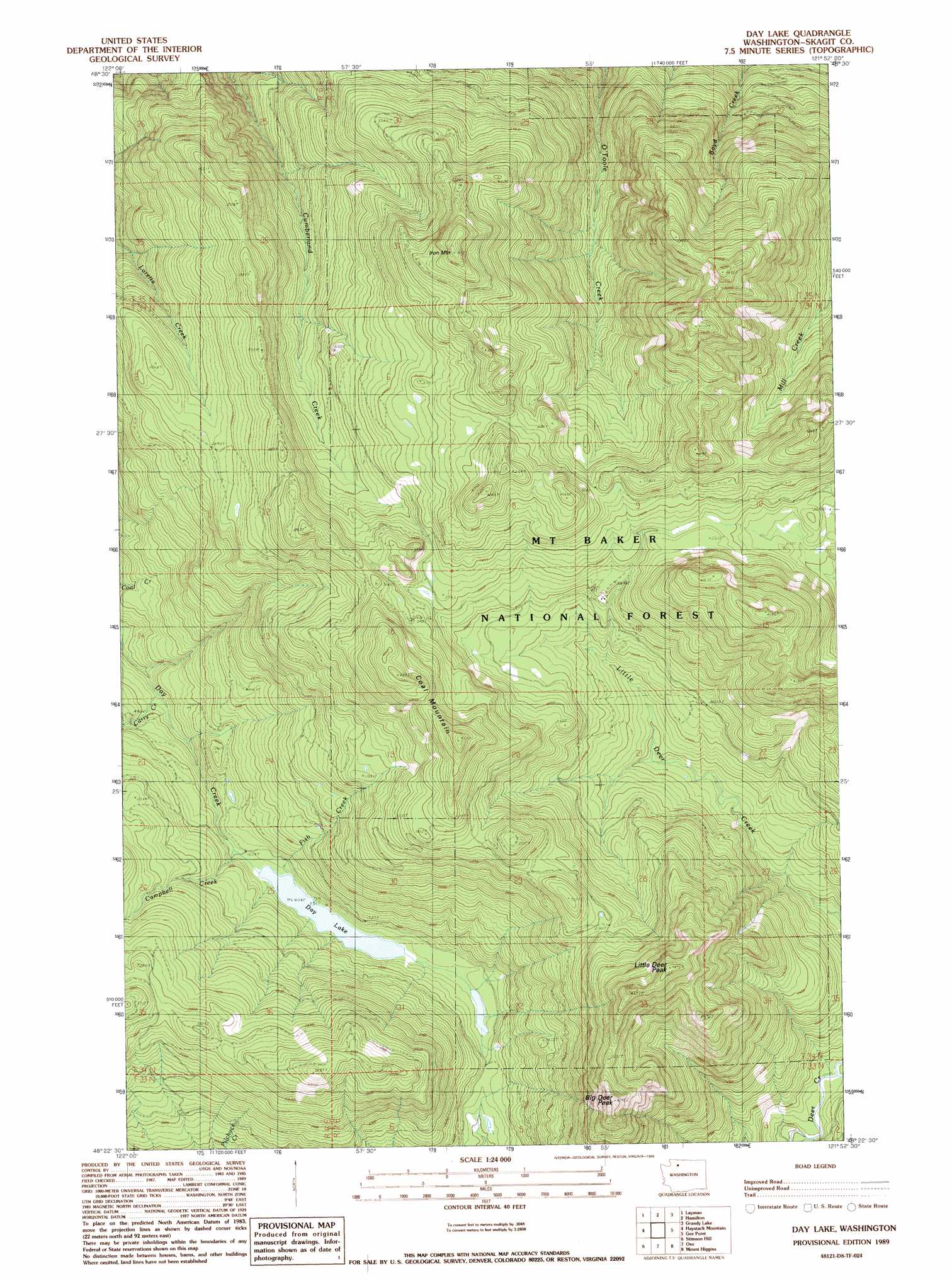
USGS Topo Quad 48121d8 - 1:24,000 scale
| Topo Map Name: | Day Lake |
| USGS Topo Quad ID: | 48121d8 |
| Print Size: | ca. 21 1/4" wide x 27" high |
| Southeast Coordinates: | 48.375° N latitude / 121.875° W longitude |
| Map Center Coordinates: | 48.4375° N latitude / 121.9375° W longitude |
| U.S. State: | WA |
| Filename: | o48121d8.jpg |
| Download Map JPG Image: | Day Lake topo map 1:24,000 scale |
| Map Type: | Topographic |
| Topo Series: | 7.5´ |
| Map Scale: | 1:24,000 |
| Source of Map Images: | United States Geological Survey (USGS) |
| Alternate Map Versions: |
Day Lake WA 1989, updated 1989 Download PDF Buy paper map Day Lake WA 2011 Download PDF Buy paper map Day Lake WA 2014 Download PDF Buy paper map |
| FStopo: | US Forest Service topo Day Lake is available: Download FStopo PDF Download FStopo TIF |
1:24,000 Topo Quads surrounding Day Lake
Acme |
Cavanaugh Creek |
Twin Sisters Mountain |
Baker Pass |
Welker Peak |
Sedro-Woolley North |
Lyman |
Hamilton |
Grandy Lake |
Lake Shannon |
Sedro-Woolley South |
Haystack Mountain |
Day Lake |
Gee Point |
Finney Peak |
Mcmurray |
Stimson Hill |
Oso |
Mount Higgins |
Fortson |
Arlington West |
Arlington East |
Riley Lake |
Meadow Mountain |
Whitehorse Mountain |
> Back to 48121a1 at 1:100,000 scale
> Back to 48120a1 at 1:250,000 scale
> Back to U.S. Topo Maps home
Day Lake topo map: Gazetteer
Day Lake: Lakes
Day Lake elevation 490m 1607′Day Lake: Streams
Campbell Creek elevation 493m 1617′Carry Creek elevation 406m 1332′
Fish Creek elevation 490m 1607′
Day Lake: Summits
Big Deer Peak elevation 1237m 4058′Coal Mountain elevation 1276m 4186′
Iron Mountain elevation 1406m 4612′
Little Deer Peak elevation 1308m 4291′
Day Lake digital topo map on disk
Buy this Day Lake topo map showing relief, roads, GPS coordinates and other geographical features, as a high-resolution digital map file on DVD: