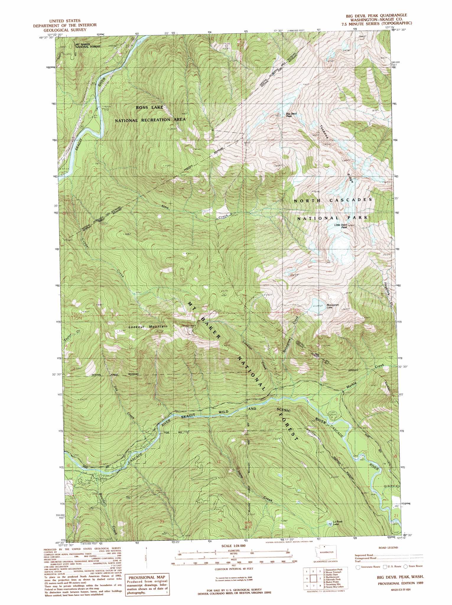
Big Devil Peak Topo Map Washington
To zoom in, hover over the map of Big Devil Peak
USGS Topo Quad 48121e3 - 1:24,000 scale
| Topo Map Name: | Big Devil Peak |
| USGS Topo Quad ID: | 48121e3 |
| Print Size: | ca. 21 1/4" wide x 27" high |
| Southeast Coordinates: | 48.5° N latitude / 121.25° W longitude |
| Map Center Coordinates: | 48.5625° N latitude / 121.3125° W longitude |
| U.S. State: | WA |
| Filename: | o48121e3.jpg |
| Download Map JPG Image: | Big Devil Peak topo map 1:24,000 scale |
| Map Type: | Topographic |
| Topo Series: | 7.5´ |
| Map Scale: | 1:24,000 |
| Source of Map Images: | United States Geological Survey (USGS) |
| Alternate Map Versions: |
Big Devil Peak WA 1989, updated 1989 Download PDF Buy paper map Big Devil Peak WA 1999, updated 2002 Download PDF Buy paper map Big Devil Peak WA 2011 Download PDF Buy paper map Big Devil Peak WA 2014 Download PDF Buy paper map |
| FStopo: | US Forest Service topo Big Devil Peak is available: Download FStopo PDF Download FStopo TIF |
1:24,000 Topo Quads surrounding Big Devil Peak
Mount Shuksan |
Mount Blum |
Mount Challenger |
Mount Prophet |
Pumpkin Mountain |
Bacon Peak |
Damnation Peak |
Mount Triumph |
Diablo Dam |
Ross Dam |
Sauk Mountain |
Marblemount |
Big Devil Peak |
Eldorado Peak |
Forbidden Peak |
Rockport |
Illabot Peaks |
Snowking Mountain |
Sonny Boy Lakes |
Cascade Pass |
Darrington |
Prairie Mountain |
Huckleberry Mountain |
Downey Mountain |
Dome Peak |
> Back to 48121e1 at 1:100,000 scale
> Back to 48120a1 at 1:250,000 scale
> Back to U.S. Topo Maps home
Big Devil Peak topo map: Gazetteer
Big Devil Peak: Lakes
La Rush Lake elevation 966m 3169′Monogram Lake elevation 1487m 4878′
Big Devil Peak: Mines
Skagit Talc Mine (historical) elevation 286m 938′Big Devil Peak: Ridges
Teebone Ridge elevation 2014m 6607′Big Devil Peak: Streams
Alma Creek elevation 124m 406′Boulder Creek elevation 137m 449′
Copper Creek elevation 108m 354′
Day Creek elevation 170m 557′
Irene Creek elevation 223m 731′
Lookout Creek elevation 269m 882′
Marble Creek elevation 297m 974′
Monogram Creek elevation 285m 935′
Sibley Creek elevation 305m 1000′
Big Devil Peak: Summits
Big Devil Peak elevation 2058m 6751′Little Devil Peak elevation 2111m 6925′
Lookout Mountain elevation 1734m 5688′
Big Devil Peak digital topo map on disk
Buy this Big Devil Peak topo map showing relief, roads, GPS coordinates and other geographical features, as a high-resolution digital map file on DVD: