Marblemount Topo Map Washington
To zoom in, hover over the map of Marblemount
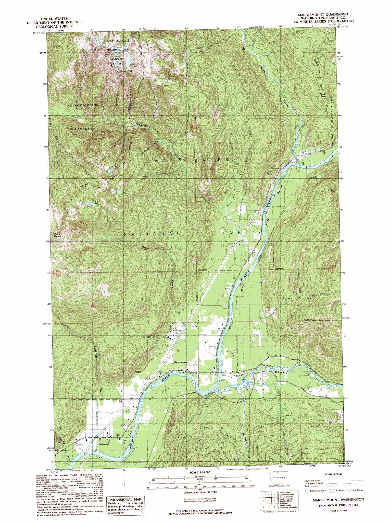
USGS Topo Quad 48121e4 - 1:24,000 scale
| Topo Map Name: | Marblemount |
| USGS Topo Quad ID: | 48121e4 |
| Print Size: | ca. 21 1/4" wide x 27" high |
| Southeast Coordinates: | 48.5° N latitude / 121.375° W longitude |
| Map Center Coordinates: | 48.5625° N latitude / 121.4375° W longitude |
| U.S. State: | WA |
| Filename: | o48121e4.jpg |
| Download Map JPG Image: | Marblemount topo map 1:24,000 scale |
| Map Type: | Topographic |
| Topo Series: | 7.5´ |
| Map Scale: | 1:24,000 |
| Source of Map Images: | United States Geological Survey (USGS) |
| Alternate Map Versions: |
Marblemount WA 1989, updated 1989 Download PDF Buy paper map Marblemount WA 2011 Download PDF Buy paper map Marblemount WA 2014 Download PDF Buy paper map |
| FStopo: | US Forest Service topo Marblemount is available: Download FStopo PDF Download FStopo TIF |
1:24,000 Topo Quads surrounding Marblemount
Shuksan Arm |
Mount Shuksan |
Mount Blum |
Mount Challenger |
Mount Prophet |
Welker Peak |
Bacon Peak |
Damnation Peak |
Mount Triumph |
Diablo Dam |
Lake Shannon |
Sauk Mountain |
Marblemount |
Big Devil Peak |
Eldorado Peak |
Finney Peak |
Rockport |
Illabot Peaks |
Snowking Mountain |
Sonny Boy Lakes |
Fortson |
Darrington |
Prairie Mountain |
Huckleberry Mountain |
Downey Mountain |
> Back to 48121e1 at 1:100,000 scale
> Back to 48120a1 at 1:250,000 scale
> Back to U.S. Topo Maps home
Marblemount topo map: Gazetteer
Marblemount: Forests
Marblemount Ranger District elevation 142m 465′Marblemount: Lakes
Olson Lake elevation 1228m 4028′Marblemount: Populated Places
Corkindale elevation 89m 291′Marblemount elevation 96m 314′
Portage elevation 113m 370′
Marblemount: Streams
Backus Creek elevation 108m 354′Bacon Creek elevation 112m 367′
Cascade River elevation 95m 311′
Clark Creek elevation 99m 324′
Corkindale Creek elevation 86m 282′
Diobsud Creek elevation 107m 351′
Jordan Creek elevation 104m 341′
Oakes Creek elevation 155m 508′
Olson Creek elevation 111m 364′
Rocky Creek elevation 85m 278′
Taylor Creek elevation 143m 469′
Marblemount: Summits
Bacon Point elevation 515m 1689′Diobsud Buttes elevation 1785m 5856′
Marblemount digital topo map on disk
Buy this Marblemount topo map showing relief, roads, GPS coordinates and other geographical features, as a high-resolution digital map file on DVD: