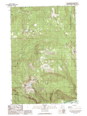
Sauk Mountain Topo Map Washington
To zoom in, hover over the map of Sauk Mountain
USGS Topo Quad 48121e5 - 1:24,000 scale
| Topo Map Name: | Sauk Mountain |
| USGS Topo Quad ID: | 48121e5 |
| Print Size: | ca. 21 1/4" wide x 27" high |
| Southeast Coordinates: | 48.5° N latitude / 121.5° W longitude |
| Map Center Coordinates: | 48.5625° N latitude / 121.5625° W longitude |
| U.S. State: | WA |
| Filename: | o48121e5.jpg |
| Download Map JPG Image: | Sauk Mountain topo map 1:24,000 scale |
| Map Type: | Topographic |
| Topo Series: | 7.5´ |
| Map Scale: | 1:24,000 |
| Source of Map Images: | United States Geological Survey (USGS) |
| Alternate Map Versions: |
Sauk Mountain WA 1989, updated 1989 Download PDF Buy paper map Sauk Mountain WA 2011 Download PDF Buy paper map Sauk Mountain WA 2014 Download PDF Buy paper map |
| FStopo: | US Forest Service topo Sauk Mountain is available: Download FStopo PDF Download FStopo TIF |
1:24,000 Topo Quads surrounding Sauk Mountain
> Back to 48121e1 at 1:100,000 scale
> Back to 48120a1 at 1:250,000 scale
> Back to U.S. Topo Maps home
Sauk Mountain topo map: Gazetteer
Sauk Mountain: Lakes
Bald Lake elevation 1131m 3710′Clear Lake elevation 1241m 4071′
Edgar Lake elevation 1021m 3349′
Lake Stilwell elevation 1270m 4166′
Sauk Lake elevation 1252m 4107′
Sauk Mountain: Streams
Helen Creek elevation 501m 1643′Patent Creek elevation 574m 1883′
Watson Creek elevation 624m 2047′
Sauk Mountain: Summits
Bald Mountain elevation 1647m 5403′Helen Buttes elevation 1586m 5203′
Sauk Mountain elevation 1633m 5357′
Sauk Mountain digital topo map on disk
Buy this Sauk Mountain topo map showing relief, roads, GPS coordinates and other geographical features, as a high-resolution digital map file on DVD:


