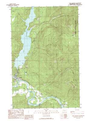
Lake Shannon Topo Map Washington
To zoom in, hover over the map of Lake Shannon
USGS Topo Quad 48121e6 - 1:24,000 scale
| Topo Map Name: | Lake Shannon |
| USGS Topo Quad ID: | 48121e6 |
| Print Size: | ca. 21 1/4" wide x 27" high |
| Southeast Coordinates: | 48.5° N latitude / 121.625° W longitude |
| Map Center Coordinates: | 48.5625° N latitude / 121.6875° W longitude |
| U.S. State: | WA |
| Filename: | o48121e6.jpg |
| Download Map JPG Image: | Lake Shannon topo map 1:24,000 scale |
| Map Type: | Topographic |
| Topo Series: | 7.5´ |
| Map Scale: | 1:24,000 |
| Source of Map Images: | United States Geological Survey (USGS) |
| Alternate Map Versions: |
Lake Shannon WA 1989, updated 1989 Download PDF Buy paper map Lake Shannon WA 2011 Download PDF Buy paper map Lake Shannon WA 2014 Download PDF Buy paper map |
| FStopo: | US Forest Service topo Lake Shannon is available: Download FStopo PDF Download FStopo TIF |
1:24,000 Topo Quads surrounding Lake Shannon
> Back to 48121e1 at 1:100,000 scale
> Back to 48120a1 at 1:250,000 scale
> Back to U.S. Topo Maps home
Lake Shannon topo map: Gazetteer
Lake Shannon: Dams
Baker Dam elevation 69m 226′Bear Creek Dam elevation 284m 931′
Lake Shannon: Lakes
Everett Lake elevation 203m 666′Thunder Lakes elevation 1379m 4524′
Lake Shannon: Parks
Upper Skagit Garden Club Park elevation 87m 285′Lake Shannon: Populated Places
Concrete elevation 84m 275′Nestos (historical) elevation 62m 203′
Van Horn elevation 76m 249′
Lake Shannon: Reservoirs
Lake Shannon elevation 69m 226′Lake Shannon: Ridges
Jackman Ridge elevation 1140m 3740′Lake Shannon: Streams
Bear Creek elevation 186m 610′Cooper Creek elevation 61m 200′
Jackman Creek elevation 62m 203′
South Fork Thunder Creek elevation 330m 1082′
Survey Creek elevation 571m 1873′
Threemile Creek elevation 139m 456′
Thunder Creek elevation 140m 459′
Weber Creek elevation 371m 1217′
Lake Shannon digital topo map on disk
Buy this Lake Shannon topo map showing relief, roads, GPS coordinates and other geographical features, as a high-resolution digital map file on DVD:


