Mount Triumph Topo Map Washington
To zoom in, hover over the map of Mount Triumph
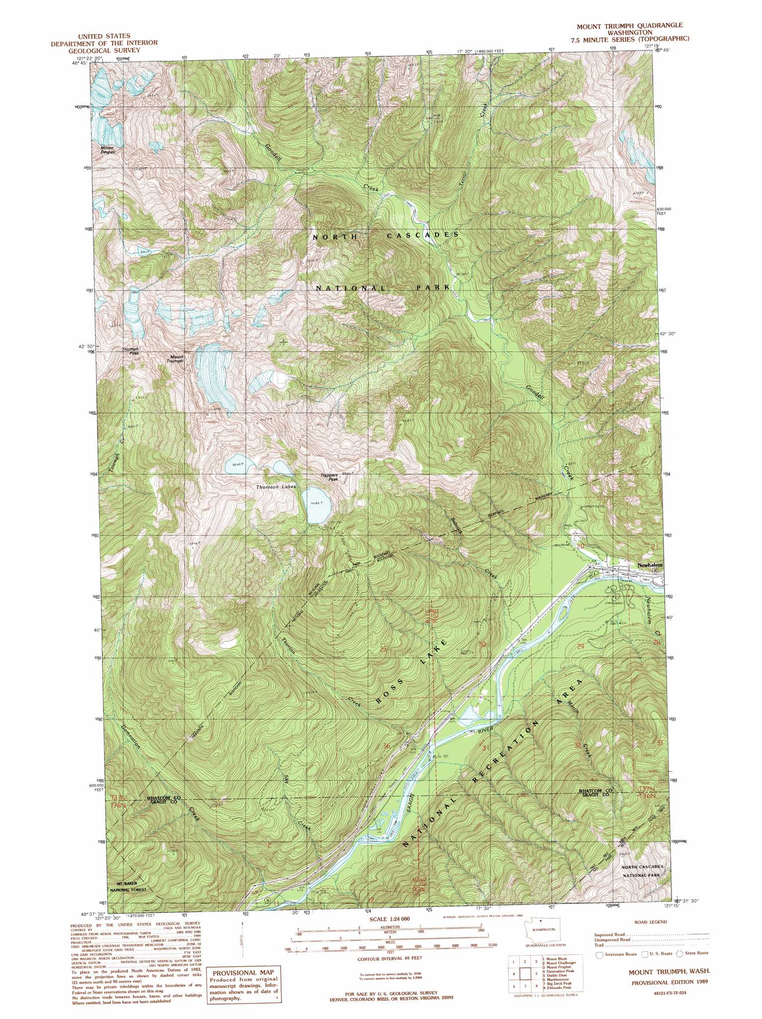
USGS Topo Quad 48121f3 - 1:24,000 scale
| Topo Map Name: | Mount Triumph |
| USGS Topo Quad ID: | 48121f3 |
| Print Size: | ca. 21 1/4" wide x 27" high |
| Southeast Coordinates: | 48.625° N latitude / 121.25° W longitude |
| Map Center Coordinates: | 48.6875° N latitude / 121.3125° W longitude |
| U.S. State: | WA |
| Filename: | o48121f3.jpg |
| Download Map JPG Image: | Mount Triumph topo map 1:24,000 scale |
| Map Type: | Topographic |
| Topo Series: | 7.5´ |
| Map Scale: | 1:24,000 |
| Source of Map Images: | United States Geological Survey (USGS) |
| Alternate Map Versions: |
Mount Triumph WA 1989, updated 1989 Download PDF Buy paper map Mount Triumph WA 1999, updated 2002 Download PDF Buy paper map Mount Triumph WA 2011 Download PDF Buy paper map Mount Triumph WA 2014 Download PDF Buy paper map |
| FStopo: | US Forest Service topo Mount Triumph is available: Download FStopo PDF Download FStopo TIF |
1:24,000 Topo Quads surrounding Mount Triumph
Mount Sefrit |
Copper Mountain |
Mount Redoubt |
Mount Spickard |
Hozomeen Mountain |
Mount Shuksan |
Mount Blum |
Mount Challenger |
Mount Prophet |
Pumpkin Mountain |
Bacon Peak |
Damnation Peak |
Mount Triumph |
Diablo Dam |
Ross Dam |
Sauk Mountain |
Marblemount |
Big Devil Peak |
Eldorado Peak |
Forbidden Peak |
Rockport |
Illabot Peaks |
Snowking Mountain |
Sonny Boy Lakes |
Cascade Pass |
> Back to 48121e1 at 1:100,000 scale
> Back to 48120a1 at 1:250,000 scale
> Back to U.S. Topo Maps home
Mount Triumph topo map: Gazetteer
Mount Triumph: Gaps
Triumph Pass elevation 1749m 5738′Mount Triumph: Lakes
Thornton Lakes elevation 1437m 4714′Mount Triumph: Parks
North Cascades National Park elevation 225m 738′Mount Triumph: Streams
Babcock Creek elevation 145m 475′Damnation Creek elevation 125m 410′
Goodell Creek elevation 145m 475′
Martin Creek elevation 163m 534′
Newhalem Creek elevation 147m 482′
Sky Creek elevation 127m 416′
Terror Creek elevation 361m 1184′
Thorton Creek elevation 133m 436′
Mount Triumph: Summits
Mount Despair elevation 1976m 6482′Mount Triumph elevation 2124m 6968′
Trappers Peak elevation 1804m 5918′
Mount Triumph digital topo map on disk
Buy this Mount Triumph topo map showing relief, roads, GPS coordinates and other geographical features, as a high-resolution digital map file on DVD: