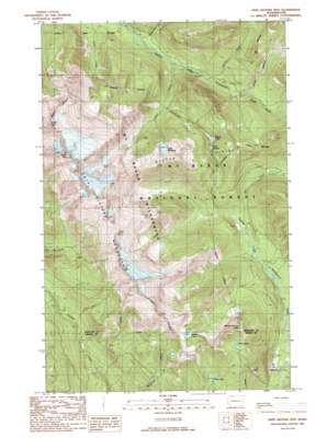
Twin Sisters Mountain Topo Map Washington
To zoom in, hover over the map of Twin Sisters Mountain
USGS Topo Quad 48121f8 - 1:24,000 scale
| Topo Map Name: | Twin Sisters Mountain |
| USGS Topo Quad ID: | 48121f8 |
| Print Size: | ca. 21 1/4" wide x 27" high |
| Southeast Coordinates: | 48.625° N latitude / 121.875° W longitude |
| Map Center Coordinates: | 48.6875° N latitude / 121.9375° W longitude |
| U.S. State: | WA |
| Filename: | o48121f8.jpg |
| Download Map JPG Image: | Twin Sisters Mountain topo map 1:24,000 scale |
| Map Type: | Topographic |
| Topo Series: | 7.5´ |
| Map Scale: | 1:24,000 |
| Source of Map Images: | United States Geological Survey (USGS) |
| Alternate Map Versions: |
Twin Sisters Mtn. WA 1989, updated 1989 Download PDF Buy paper map Twin Sisters Mtn. WA 1989, updated 1989 Download PDF Buy paper map Twin Sisters Mountain WA 2011 Download PDF Buy paper map Twin Sisters Mountain WA 2014 Download PDF Buy paper map |
| FStopo: | US Forest Service topo Twin Sisters Mountain is available: Download FStopo PDF Download FStopo TIF |
1:24,000 Topo Quads surrounding Twin Sisters Mountain
> Back to 48121e1 at 1:100,000 scale
> Back to 48120a1 at 1:250,000 scale
> Back to U.S. Topo Maps home
Twin Sisters Mountain topo map: Gazetteer
Twin Sisters Mountain: Gaps
Bell Pass elevation 1227m 4025′Twin Sisters Mountain: Lakes
Bear Lake elevation 1091m 3579′Elbow Lake elevation 1036m 3398′
Heart Lake elevation 1246m 4087′
Lake Doreen elevation 1034m 3392′
Lake Hildebrand elevation 1080m 3543′
Lake Wiseman elevation 1287m 4222′
Three Lakes elevation 1254m 4114′
Twin Sisters Mountain: Ranges
Twin Sisters Range elevation 1691m 5547′Twin Sisters Mountain: Ridges
Sister Divide elevation 1518m 4980′Twin Sisters Mountain: Streams
Bell Creek elevation 637m 2089′Green Creek elevation 604m 1981′
Hearty Creek elevation 610m 2001′
Hildebrand Creek elevation 764m 2506′
Rankin Creek elevation 669m 2194′
Ridley Creek elevation 790m 2591′
Wallace Creek elevation 559m 1833′
Wanlick Creek elevation 576m 1889′
Twin Sisters Mountain: Summits
George Peterson Butte elevation 1451m 4760′North Twin elevation 2027m 6650′
South Twin elevation 2123m 6965′
Twin Sisters elevation 1710m 5610′
Twin Sisters Mountain elevation 1757m 5764′
Twin Sisters Mountain digital topo map on disk
Buy this Twin Sisters Mountain topo map showing relief, roads, GPS coordinates and other geographical features, as a high-resolution digital map file on DVD:


