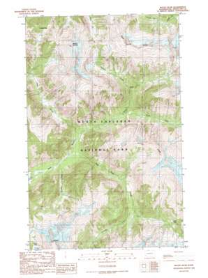
Mount Blum Topo Map Washington
To zoom in, hover over the map of Mount Blum
USGS Topo Quad 48121g4 - 1:24,000 scale
| Topo Map Name: | Mount Blum |
| USGS Topo Quad ID: | 48121g4 |
| Print Size: | ca. 21 1/4" wide x 27" high |
| Southeast Coordinates: | 48.75° N latitude / 121.375° W longitude |
| Map Center Coordinates: | 48.8125° N latitude / 121.4375° W longitude |
| U.S. State: | WA |
| Filename: | o48121g4.jpg |
| Download Map JPG Image: | Mount Blum topo map 1:24,000 scale |
| Map Type: | Topographic |
| Topo Series: | 7.5´ |
| Map Scale: | 1:24,000 |
| Source of Map Images: | United States Geological Survey (USGS) |
| Alternate Map Versions: |
Mount Blum WA 1989, updated 1989 Download PDF Buy paper map Mount Blum WA 2011 Download PDF Buy paper map Mount Blum WA 2014 Download PDF Buy paper map |
1:24,000 Topo Quads surrounding Mount Blum
> Back to 48121e1 at 1:100,000 scale
> Back to 48120a1 at 1:250,000 scale
> Back to U.S. Topo Maps home
Mount Blum topo map: Gazetteer
Mount Blum: Gaps
Chilliwack Pass elevation 1259m 4130′Jasper Pass elevation 1336m 4383′
Mount Blum: Ridges
Easy Ridge elevation 2015m 6610′Pioneer Ridge elevation 2010m 6594′
Mount Blum: Streams
Bald Eagle Creek elevation 349m 1145′Lonesome Creek elevation 760m 2493′
Mineral Creek elevation 729m 2391′
Pass Creek elevation 372m 1220′
Picket Creek elevation 540m 1771′
Scramble Creek elevation 341m 1118′
Tapto Creek elevation 1221m 4005′
Mount Blum: Summits
Easy Peak elevation 2018m 6620′Mineral Mountain elevation 2028m 6653′
Mount Blum elevation 2328m 7637′
Whatcom Peak elevation 2067m 6781′
Mount Blum digital topo map on disk
Buy this Mount Blum topo map showing relief, roads, GPS coordinates and other geographical features, as a high-resolution digital map file on DVD:


