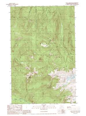
Groat Mountain Topo Map Washington
To zoom in, hover over the map of Groat Mountain
USGS Topo Quad 48121g8 - 1:24,000 scale
| Topo Map Name: | Groat Mountain |
| USGS Topo Quad ID: | 48121g8 |
| Print Size: | ca. 21 1/4" wide x 27" high |
| Southeast Coordinates: | 48.75° N latitude / 121.875° W longitude |
| Map Center Coordinates: | 48.8125° N latitude / 121.9375° W longitude |
| U.S. State: | WA |
| Filename: | o48121g8.jpg |
| Download Map JPG Image: | Groat Mountain topo map 1:24,000 scale |
| Map Type: | Topographic |
| Topo Series: | 7.5´ |
| Map Scale: | 1:24,000 |
| Source of Map Images: | United States Geological Survey (USGS) |
| Alternate Map Versions: |
Groat Mountain WA 1989, updated 1989 Download PDF Buy paper map Groat Mountain WA 2011 Download PDF Buy paper map Groat Mountain WA 2014 Download PDF Buy paper map |
| FStopo: | US Forest Service topo Groat Mountain is available: Download FStopo PDF Download FStopo TIF |
1:24,000 Topo Quads surrounding Groat Mountain
> Back to 48121e1 at 1:100,000 scale
> Back to 48120a1 at 1:250,000 scale
> Back to U.S. Topo Maps home
Groat Mountain topo map: Gazetteer
Groat Mountain: Cliffs
The Palisades elevation 760m 2493′Groat Mountain: Gaps
Coal Pass elevation 1447m 4747′Groat Mountain: Ridges
Grouse Ridge elevation 1788m 5866′Heliotrope Ridge elevation 1821m 5974′
Marmot Ridge elevation 1563m 5127′
Groat Mountain: Streams
Coal Creek elevation 533m 1748′Deep Creek elevation 374m 1227′
Falls Creek elevation 577m 1893′
Grouse Creek elevation 867m 2844′
Heliotrope Creek elevation 1048m 3438′
Kulshan Creek elevation 955m 3133′
Lookout Creek elevation 792m 2598′
Rocky Creek elevation 619m 2030′
Sister Creek elevation 500m 1640′
Smith Creek elevation 808m 2650′
Warm Creek elevation 476m 1561′
Groat Mountain: Summits
Groat Mountain elevation 1650m 5413′Grouse Butte elevation 1528m 5013′
Lookout Mountain elevation 1539m 5049′
Mount Baker Vista elevation 1531m 5022′
Groat Mountain: Valleys
The Gorge elevation 693m 2273′Groat Mountain digital topo map on disk
Buy this Groat Mountain topo map showing relief, roads, GPS coordinates and other geographical features, as a high-resolution digital map file on DVD:


