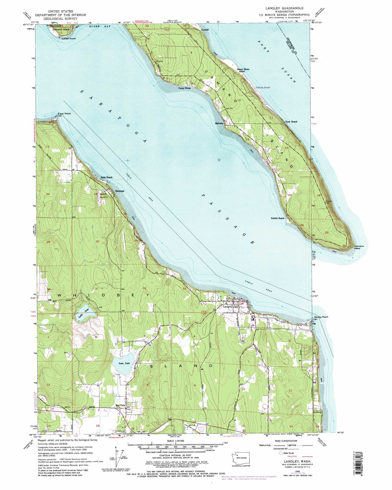
Langley Topo Map Washington
To zoom in, hover over the map of Langley
USGS Topo Quad 48122a4 - 1:24,000 scale
| Topo Map Name: | Langley |
| USGS Topo Quad ID: | 48122a4 |
| Print Size: | ca. 21 1/4" wide x 27" high |
| Southeast Coordinates: | 48° N latitude / 122.375° W longitude |
| Map Center Coordinates: | 48.0625° N latitude / 122.4375° W longitude |
| U.S. State: | WA |
| Filename: | o48122a4.jpg |
| Download Map JPG Image: | Langley topo map 1:24,000 scale |
| Map Type: | Topographic |
| Topo Series: | 7.5´ |
| Map Scale: | 1:24,000 |
| Source of Map Images: | United States Geological Survey (USGS) |
| Alternate Map Versions: |
Langley WA 1956, updated 1969 Download PDF Buy paper map Langley WA 1956, updated 1984 Download PDF Buy paper map Langley WA 2011 Download PDF Buy paper map Langley WA 2014 Download PDF Buy paper map |
1:24,000 Topo Quads surrounding Langley
Oak Harbor |
Crescent Harbor |
Utsalady |
Conway |
Mcmurray |
Coupeville |
Camano |
Juniper Beach |
Stanwood |
Arlington West |
Nordland |
Freeland |
Langley |
Tulalip |
Marysville |
Port Ludlow |
Hansville |
Maxwelton |
Mukilteo |
Everett |
Lofall |
Port Gamble |
Edmonds West |
Edmonds East |
Bothell |
> Back to 48122a1 at 1:100,000 scale
> Back to 48122a1 at 1:250,000 scale
> Back to U.S. Topo Maps home
Langley topo map: Gazetteer
Langley: Airports
Whidbey Air Park Airport elevation 83m 272′Wood Landing Strip elevation 85m 278′
Langley: Bays
Maple Cove elevation 3m 9′Port Susan elevation 0m 0′
Langley: Capes
East Point elevation 2m 6′Lowell Point elevation 14m 45′
Sandy Point elevation 1m 3′
Langley: Lakes
Lake Goss elevation 42m 137′Lone Lake elevation 6m 19′
Langley: Populated Places
Bay View elevation 15m 49′Bells Beach elevation 2m 6′
Bretland elevation 18m 59′
Camp Diana elevation 21m 68′
Langley elevation 19m 62′
Mabana elevation 27m 88′
Pebble Beach elevation 45m 147′
Saratoga elevation 29m 95′
Sunny Shore Acres elevation 5m 16′
Tyee Beach elevation 3m 9′
Langley digital topo map on disk
Buy this Langley topo map showing relief, roads, GPS coordinates and other geographical features, as a high-resolution digital map file on DVD: