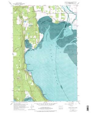
Juniper Beach Topo Map Washington
To zoom in, hover over the map of Juniper Beach
USGS Topo Quad 48122b4 - 1:24,000 scale
| Topo Map Name: | Juniper Beach |
| USGS Topo Quad ID: | 48122b4 |
| Print Size: | ca. 21 1/4" wide x 27" high |
| Southeast Coordinates: | 48.125° N latitude / 122.375° W longitude |
| Map Center Coordinates: | 48.1875° N latitude / 122.4375° W longitude |
| U.S. State: | WA |
| Filename: | o48122b4.jpg |
| Download Map JPG Image: | Juniper Beach topo map 1:24,000 scale |
| Map Type: | Topographic |
| Topo Series: | 7.5´ |
| Map Scale: | 1:24,000 |
| Source of Map Images: | United States Geological Survey (USGS) |
| Alternate Map Versions: |
Juniper Beach WA 1956, updated 1957 Download PDF Buy paper map Juniper Beach WA 1956, updated 1969 Download PDF Buy paper map Juniper Beach WA 1956, updated 1975 Download PDF Buy paper map Juniper Beach WA 1956, updated 1975 Download PDF Buy paper map Juniper Beach WA 2011 Download PDF Buy paper map Juniper Beach WA 2014 Download PDF Buy paper map |
1:24,000 Topo Quads surrounding Juniper Beach
> Back to 48122a1 at 1:100,000 scale
> Back to 48122a1 at 1:250,000 scale
> Back to U.S. Topo Maps home
Juniper Beach topo map: Gazetteer
Juniper Beach: Airports
Livingston Bay Airport elevation 1m 3′Juniper Beach: Bays
Elger Bay elevation 0m 0′Livingston Bay elevation 0m 0′
Triangle Cove elevation 1m 3′
Juniper Beach: Capes
Barnum Point elevation 8m 26′Juniper Beach: Channels
South Pass elevation 2m 6′West Pass elevation 2m 6′
Juniper Beach: Dams
Kristofferson Lake Dam elevation 38m 124′Juniper Beach: Guts
Davis Slough elevation 2m 6′Juniper Beach: Lakes
Cranberry Lake elevation 79m 259′Lindsay Lake elevation 97m 318′
Lost Lake elevation 79m 259′
Smith Lake elevation 61m 200′
Juniper Beach: Parks
Camano Island State Park elevation 43m 141′Juniper Beach: Populated Places
Driftwood Shores elevation 2m 6′Juniper Beach elevation 22m 72′
Lona Beach elevation 2m 6′
New Utsaladdy elevation 77m 252′
Terrys Corner elevation 12m 39′
Juniper Beach: Reservoirs
Kristoferson Lake elevation 37m 121′Juniper Beach: Streams
Stillaguamish River elevation 1m 3′Juniper Beach digital topo map on disk
Buy this Juniper Beach topo map showing relief, roads, GPS coordinates and other geographical features, as a high-resolution digital map file on DVD:


