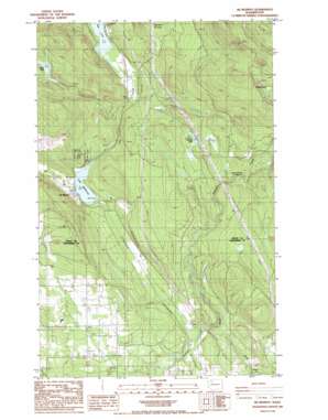
Mcmurray Topo Map Washington
To zoom in, hover over the map of Mcmurray
USGS Topo Quad 48122c2 - 1:24,000 scale
| Topo Map Name: | Mcmurray |
| USGS Topo Quad ID: | 48122c2 |
| Print Size: | ca. 21 1/4" wide x 27" high |
| Southeast Coordinates: | 48.25° N latitude / 122.125° W longitude |
| Map Center Coordinates: | 48.3125° N latitude / 122.1875° W longitude |
| U.S. State: | WA |
| Filename: | o48122c2.jpg |
| Download Map JPG Image: | Mcmurray topo map 1:24,000 scale |
| Map Type: | Topographic |
| Topo Series: | 7.5´ |
| Map Scale: | 1:24,000 |
| Source of Map Images: | United States Geological Survey (USGS) |
| Alternate Map Versions: |
Mc Murray WA 1985, updated 1985 Download PDF Buy paper map McMurray WA 2011 Download PDF Buy paper map McMurray WA 2014 Download PDF Buy paper map |
1:24,000 Topo Quads surrounding Mcmurray
> Back to 48122a1 at 1:100,000 scale
> Back to 48122a1 at 1:250,000 scale
> Back to U.S. Topo Maps home
Mcmurray topo map: Gazetteer
Mcmurray: Lakes
Devils Lake elevation 268m 879′Lake McMurray elevation 75m 246′
Seabury Pond elevation 412m 1351′
Summer Lake elevation 170m 557′
Mcmurray: Populated Places
Lake McMurray elevation 84m 275′McMurray elevation 88m 288′
Pilchuck elevation 43m 141′
Mcmurray: Streams
Crane Creek elevation 166m 544′Lake Creek elevation 26m 85′
Mcmurray digital topo map on disk
Buy this Mcmurray topo map showing relief, roads, GPS coordinates and other geographical features, as a high-resolution digital map file on DVD:


