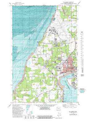
Oak Harbor Topo Map Washington
To zoom in, hover over the map of Oak Harbor
USGS Topo Quad 48122c6 - 1:24,000 scale
| Topo Map Name: | Oak Harbor |
| USGS Topo Quad ID: | 48122c6 |
| Print Size: | ca. 21 1/4" wide x 27" high |
| Southeast Coordinates: | 48.25° N latitude / 122.625° W longitude |
| Map Center Coordinates: | 48.3125° N latitude / 122.6875° W longitude |
| U.S. State: | WA |
| Filename: | o48122c6.jpg |
| Download Map JPG Image: | Oak Harbor topo map 1:24,000 scale |
| Map Type: | Topographic |
| Topo Series: | 7.5´ |
| Map Scale: | 1:24,000 |
| Source of Map Images: | United States Geological Survey (USGS) |
| Alternate Map Versions: |
Oak Harbor WA 1973, updated 1977 Download PDF Buy paper map Oak Harbor WA 1973, updated 1981 Download PDF Buy paper map Oak Harbor WA 1973, updated 1981 Download PDF Buy paper map Oak Harbor WA 1998, updated 2002 Download PDF Buy paper map Oak Harbor WA 2011 Download PDF Buy paper map Oak Harbor WA 2014 Download PDF Buy paper map |
1:24,000 Topo Quads surrounding Oak Harbor
> Back to 48122a1 at 1:100,000 scale
> Back to 48122a1 at 1:250,000 scale
> Back to U.S. Topo Maps home
Oak Harbor topo map: Gazetteer
Oak Harbor: Bars
Klootchman Rock elevation 0m 0′Oak Harbor: Bays
Oak Harbor elevation 0m 0′Oak Harbor: Capes
Maylor Point elevation 10m 32′Rocky Point elevation 1m 3′
Oak Harbor: Dams
Loers Dam elevation 34m 111′Oak Harbor: Islands
Whidbey Island elevation 66m 216′Oak Harbor: Lakes
Hastie Lake elevation 43m 141′Oak Harbor: Parks
Joseph Whidbey State Park elevation 38m 124′Smith Park elevation 19m 62′
Oak Harbor: Populated Places
Marketown elevation 46m 150′Oak Harbor elevation 29m 95′
Swantown elevation 12m 39′
Oak Harbor: Reservoirs
Loers Pond elevation 33m 108′Oak Harbor: Summits
Monkey Hill elevation 75m 246′Scenic Heights elevation 69m 226′
Oak Harbor: Swamps
Waterloo Marsh elevation 36m 118′Oak Harbor digital topo map on disk
Buy this Oak Harbor topo map showing relief, roads, GPS coordinates and other geographical features, as a high-resolution digital map file on DVD:


