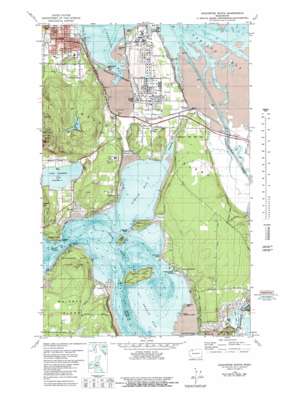
Anacortes South Topo Map Washington
To zoom in, hover over the map of Anacortes South
USGS Topo Quad 48122d5 - 1:24,000 scale
| Topo Map Name: | Anacortes South |
| USGS Topo Quad ID: | 48122d5 |
| Print Size: | ca. 21 1/4" wide x 27" high |
| Southeast Coordinates: | 48.375° N latitude / 122.5° W longitude |
| Map Center Coordinates: | 48.4375° N latitude / 122.5625° W longitude |
| U.S. State: | WA |
| Filename: | o48122d5.jpg |
| Download Map JPG Image: | Anacortes South topo map 1:24,000 scale |
| Map Type: | Topographic |
| Topo Series: | 7.5´ |
| Map Scale: | 1:24,000 |
| Source of Map Images: | United States Geological Survey (USGS) |
| Alternate Map Versions: |
Anacortes South WA 1978, updated 1979 Download PDF Buy paper map Anacortes South WA 1978, updated 1981 Download PDF Buy paper map Anacortes South WA 1978, updated 1981 Download PDF Buy paper map Anacortes South WA 1998, updated 2002 Download PDF Buy paper map Anacortes South WA 2011 Download PDF Buy paper map Anacortes South WA 2014 Download PDF Buy paper map |
1:24,000 Topo Quads surrounding Anacortes South
> Back to 48122a1 at 1:100,000 scale
> Back to 48122a1 at 1:250,000 scale
> Back to U.S. Topo Maps home
Anacortes South topo map: Gazetteer
Anacortes South: Airports
Becker's Landing Airport elevation 47m 154′Anacortes South: Bays
Fidalgo Bay elevation 0m 0′Kiket Bay elevation 0m 0′
Lang Bay elevation 0m 0′
Marthas Bay elevation 0m 0′
Shelter Bay elevation 2m 6′
Similk Bay elevation 0m 0′
Turners Bay elevation 0m 0′
Anacortes South: Capes
Ben Ure Spit elevation 1m 3′Crandall Spit elevation 1m 3′
Flagstaff Point elevation 10m 32′
Galliher Point elevation 25m 82′
Hoypus Point elevation 5m 16′
Lone Tree Point elevation 1m 3′
March Point elevation 20m 65′
Pull and Be Damned Point elevation 5m 16′
Snee-oosh Point elevation 5m 16′
Weavering Spit elevation 3m 9′
Yokeko Point elevation 3m 9′
Anacortes South: Guts
Blind Slough elevation 2m 6′Anacortes South: Islands
Deadman Island elevation 18m 59′Hope Island elevation 48m 157′
Kiket Island elevation 45m 147′
Little Deadman Island elevation 9m 29′
Skagit Island elevation 39m 127′
Tonkon Island elevation 0m 0′
Anacortes South: Lakes
Lake Campbell elevation 15m 49′Whistle Lake elevation 133m 436′
Anacortes South: Parks
John Storvik Playground elevation 32m 104′Mount Erie Park elevation 277m 908′
Anacortes South: Populated Places
Dewey elevation 14m 45′Gibraltar elevation 36m 118′
Howards Corner elevation 57m 187′
Sharpes Corner elevation 10m 32′
Shelter Bay elevation 3m 9′
Similk Beach elevation 15m 49′
Snee Oosh elevation 27m 88′
Swinomish Village elevation 68m 223′
West Shore elevation 27m 88′
Whitmarsh Junction elevation 3m 9′
Yokeko Point elevation 24m 78′
Anacortes South: Summits
Hoypus Hill elevation 126m 413′Troxel Hill elevation 49m 160′
Anacortes South: Swamps
Old Channel elevation 1m 3′Anacortes South digital topo map on disk
Buy this Anacortes South topo map showing relief, roads, GPS coordinates and other geographical features, as a high-resolution digital map file on DVD:


