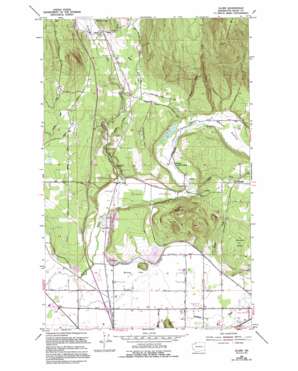
Alger Topo Map Washington
To zoom in, hover over the map of Alger
USGS Topo Quad 48122e3 - 1:24,000 scale
| Topo Map Name: | Alger |
| USGS Topo Quad ID: | 48122e3 |
| Print Size: | ca. 21 1/4" wide x 27" high |
| Southeast Coordinates: | 48.5° N latitude / 122.25° W longitude |
| Map Center Coordinates: | 48.5625° N latitude / 122.3125° W longitude |
| U.S. State: | WA |
| Filename: | o48122e3.jpg |
| Download Map JPG Image: | Alger topo map 1:24,000 scale |
| Map Type: | Topographic |
| Topo Series: | 7.5´ |
| Map Scale: | 1:24,000 |
| Source of Map Images: | United States Geological Survey (USGS) |
| Alternate Map Versions: |
Alger WA 1952, updated 1954 Download PDF Buy paper map Alger WA 1952, updated 1969 Download PDF Buy paper map Alger WA 1952, updated 1977 Download PDF Buy paper map Alger WA 1952, updated 1994 Download PDF Buy paper map Alger WA 1998, updated 2003 Download PDF Buy paper map Alger WA 2011 Download PDF Buy paper map Alger WA 2014 Download PDF Buy paper map |
1:24,000 Topo Quads surrounding Alger
> Back to 48122e1 at 1:100,000 scale
> Back to 48122a1 at 1:250,000 scale
> Back to U.S. Topo Maps home
Alger topo map: Gazetteer
Alger: Flats
Butler Flat elevation 10m 32′Garden of Eden elevation 97m 318′
Jarman Prairie elevation 21m 68′
Warner Prairie elevation 47m 154′
Alger: Parks
Donovan State Park elevation 66m 216′Alger: Populated Places
Alger elevation 82m 269′Belfast elevation 21m 68′
Hoogdal elevation 91m 298′
Alger: Streams
Brickyard Creek elevation 13m 42′Butler Creek elevation 61m 200′
Dry Creek elevation 44m 144′
Friday Creek elevation 17m 55′
Parson Creek elevation 49m 160′
Silver Creek elevation 73m 239′
Swede Creek elevation 25m 82′
Thomas Creek elevation 7m 22′
Wildes Creek elevation 50m 164′
Willard Creek elevation 14m 45′
Alger: Summits
Anderson Mountain elevation 736m 2414′Butler Hill elevation 269m 882′
Humphrey Hill elevation 126m 413′
Alger digital topo map on disk
Buy this Alger topo map showing relief, roads, GPS coordinates and other geographical features, as a high-resolution digital map file on DVD:


