Lake Whatcom Topo Map Washington
To zoom in, hover over the map of Lake Whatcom
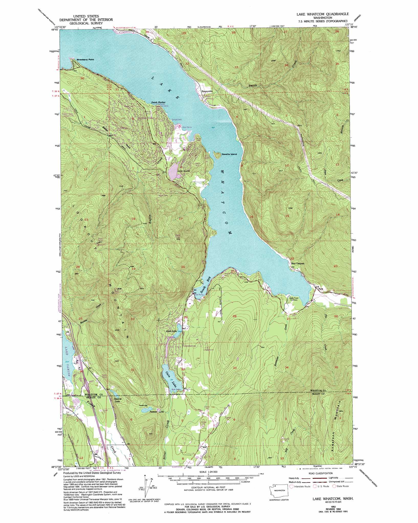
USGS Topo Quad 48122f3 - 1:24,000 scale
| Topo Map Name: | Lake Whatcom |
| USGS Topo Quad ID: | 48122f3 |
| Print Size: | ca. 21 1/4" wide x 27" high |
| Southeast Coordinates: | 48.625° N latitude / 122.25° W longitude |
| Map Center Coordinates: | 48.6875° N latitude / 122.3125° W longitude |
| U.S. State: | WA |
| Filename: | o48122f3.jpg |
| Download Map JPG Image: | Lake Whatcom topo map 1:24,000 scale |
| Map Type: | Topographic |
| Topo Series: | 7.5´ |
| Map Scale: | 1:24,000 |
| Source of Map Images: | United States Geological Survey (USGS) |
| Alternate Map Versions: |
Lake Whatcom WA 1952, updated 1953 Download PDF Buy paper map Lake Whatcom WA 1952, updated 1973 Download PDF Buy paper map Lake Whatcom WA 1952, updated 1974 Download PDF Buy paper map Lake Whatcom WA 1952, updated 1994 Download PDF Buy paper map Lake Whatcom WA 2011 Download PDF Buy paper map Lake Whatcom WA 2014 Download PDF Buy paper map |
1:24,000 Topo Quads surrounding Lake Whatcom
Bertrand Creek |
Lynden |
Sumas |
Kendall |
Maple Falls |
Ferndale |
Bellingham North |
Lawrence |
Deming |
Canyon Lake |
Eliza Island |
Bellingham South |
Lake Whatcom |
Acme |
Cavanaugh Creek |
Anacortes North |
Bow |
Alger |
Sedro-Woolley North |
Lyman |
Anacortes South |
La Conner |
Mount Vernon |
Sedro-Woolley South |
Haystack Mountain |
> Back to 48122e1 at 1:100,000 scale
> Back to 48122a1 at 1:250,000 scale
> Back to U.S. Topo Maps home
Lake Whatcom topo map: Gazetteer
Lake Whatcom: Airports
Floathaven Airstrip elevation 119m 390′Floathaven Seaplane Base elevation 170m 557′
Lake Whatcom: Bays
South Bay elevation 95m 311′Lake Whatcom: Capes
Strawberry Point elevation 95m 311′Lake Whatcom: Dams
Glenhaven Lakes Dam elevation 121m 396′Louise Lake Dam elevation 111m 364′
Lake Whatcom: Harbors
Dutch Harbor elevation 95m 311′Lake Whatcom: Islands
Reveille Island elevation 139m 456′Lake Whatcom: Lakes
Cain Lake elevation 120m 393′Palmer Lake elevation 163m 534′
Squires Lake elevation 129m 423′
Lake Whatcom: Populated Places
Blue Canyon elevation 102m 334′Sudden Valley elevation 205m 672′
Sunnyside elevation 96m 314′
Lake Whatcom: Reservoirs
Lake Louise elevation 111m 364′Reed Lake elevation 121m 396′
Lake Whatcom: Streams
Austin Creek elevation 95m 311′Bear Creek elevation 82m 269′
Beaver Creek elevation 121m 396′
Brannian Creek elevation 95m 311′
Fir Creek elevation 95m 311′
Smith Creek elevation 95m 311′
Lake Whatcom: Summits
Lookout Mountain elevation 806m 2644′Lake Whatcom digital topo map on disk
Buy this Lake Whatcom topo map showing relief, roads, GPS coordinates and other geographical features, as a high-resolution digital map file on DVD: