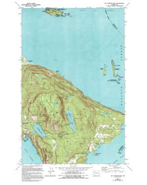
Mount Constitution Topo Map Washington
To zoom in, hover over the map of Mount Constitution
USGS Topo Quad 48122f7 - 1:24,000 scale
| Topo Map Name: | Mount Constitution |
| USGS Topo Quad ID: | 48122f7 |
| Print Size: | ca. 21 1/4" wide x 27" high |
| Southeast Coordinates: | 48.625° N latitude / 122.75° W longitude |
| Map Center Coordinates: | 48.6875° N latitude / 122.8125° W longitude |
| U.S. State: | WA |
| Filename: | o48122f7.jpg |
| Download Map JPG Image: | Mount Constitution topo map 1:24,000 scale |
| Map Type: | Topographic |
| Topo Series: | 7.5´ |
| Map Scale: | 1:24,000 |
| Source of Map Images: | United States Geological Survey (USGS) |
| Alternate Map Versions: |
Mt Constitution WA 1978, updated 1978 Download PDF Buy paper map Mt Constitution WA 1978, updated 1978 Download PDF Buy paper map Mt Constitution WA 1978, updated 1994 Download PDF Buy paper map Mount Constitution WA 2011 Download PDF Buy paper map Mount Constitution WA 2014 Download PDF Buy paper map |
1:24,000 Topo Quads surrounding Mount Constitution
> Back to 48122e1 at 1:100,000 scale
> Back to 48122a1 at 1:250,000 scale
> Back to U.S. Topo Maps home
Mount Constitution topo map: Gazetteer
Mount Constitution: Airports
Rosario Seaplane Base elevation 0m 0′Mount Constitution: Bays
Cascade Bay elevation 0m 0′Doe Bay elevation 0m 0′
Rolfe Cove elevation 9m 29′
Mount Constitution: Beaches
Chin-Chin-Tse-Tung elevation 2m 6′Mount Constitution: Capes
Eagle Point elevation 8m 26′Kangaroo Point elevation 6m 19′
Kangaroo Point (historical) elevation 0m 0′
Rolfe Cape elevation 0m 0′
Rosario Point elevation 14m 45′
Mount Constitution: Dams
Boyd Lower Reservoir Dam elevation 118m 387′Boyd Middle Reservoir Dam elevation 145m 475′
Cascade Lake Dam elevation 100m 328′
Mountain Lake Dam elevation 281m 921′
Utter Dam elevation 138m 452′
Mount Constitution: Falls
Cascade Falls elevation 155m 508′Cavern Falls elevation 189m 620′
Hidden Falls elevation 222m 728′
Rustic Falls elevation 165m 541′
Mount Constitution: Islands
Barnes Island elevation 30m 98′Clark Island elevation 30m 98′
Doe Island elevation 15m 49′
Little Sister elevation 6m 19′
Lone Tree Island elevation 14m 45′
Matia Island elevation 34m 111′
Peapod Rocks elevation 0m 0′
Puffin Island elevation 28m 91′
South Peapod elevation 8m 26′
The Sisters elevation 0m 0′
Mount Constitution: Lakes
Day Lake elevation 383m 1256′Flahertys Pond elevation 136m 446′
Mountain Lake elevation 281m 921′
Summit Lake elevation 650m 2132′
Twin Lakes elevation 342m 1122′
Mount Constitution: Parks
Clark Island State Park elevation 30m 98′Doe Island Marine State Park elevation 15m 49′
Matia Island State Park elevation 33m 108′
Moran State Park elevation 287m 941′
Mount Constitution: Populated Places
Buckhorn elevation 15m 49′Doe Bay elevation 9m 29′
Sea Acre elevation 10m 32′
Mount Constitution: Reservoirs
Boyd Lower Reservoir elevation 118m 387′Boyd Middle Reservoir elevation 145m 475′
Cascade Lake elevation 100m 328′
Mount Constitution: Ridges
Hidden Ridge elevation 643m 2109′Mount Constitution: Springs
Cold Spring elevation 619m 2030′Mount Constitution: Streams
Cold Creek elevation 110m 360′Moran Creek elevation 109m 357′
Paul Creek elevation 202m 662′
Mount Constitution: Summits
Buck Mountain elevation 447m 1466′Entrance Mountain elevation 360m 1181′
False Summit elevation 697m 2286′
Little Summit elevation 613m 2011′
Mount Constitution elevation 732m 2401′
Mount Pickett elevation 533m 1748′
Raccoon Point elevation 2m 6′
Mount Constitution digital topo map on disk
Buy this Mount Constitution topo map showing relief, roads, GPS coordinates and other geographical features, as a high-resolution digital map file on DVD:


