Canyon Lake Topo Map Washington
To zoom in, hover over the map of Canyon Lake
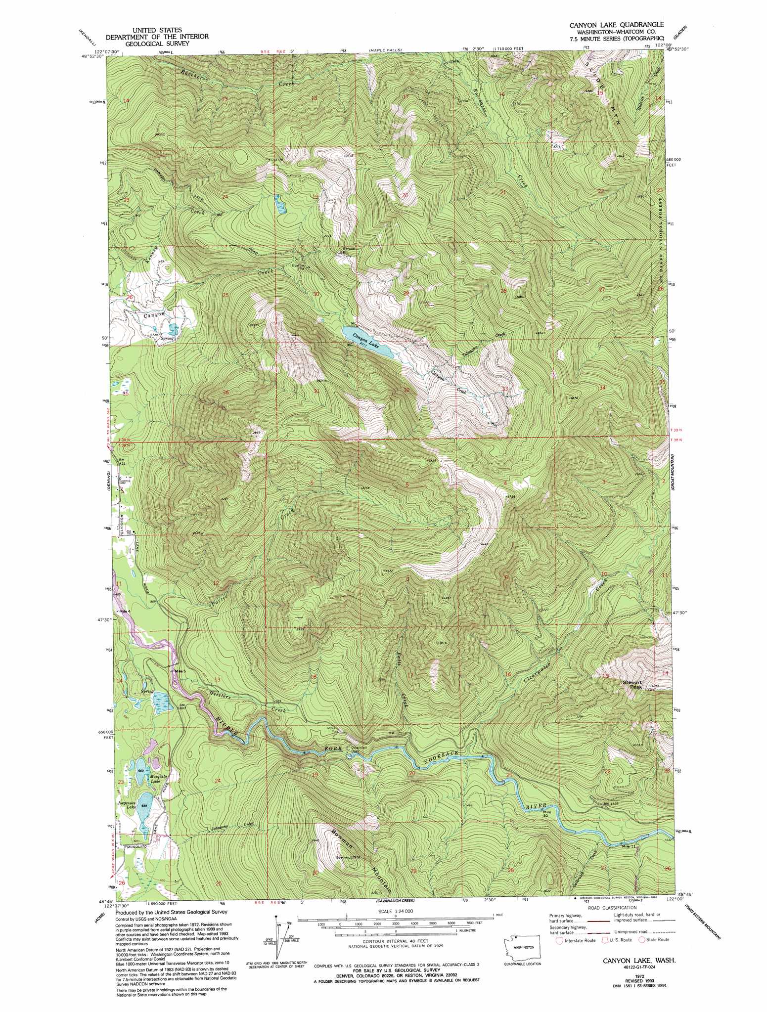
USGS Topo Quad 48122g1 - 1:24,000 scale
| Topo Map Name: | Canyon Lake |
| USGS Topo Quad ID: | 48122g1 |
| Print Size: | ca. 21 1/4" wide x 27" high |
| Southeast Coordinates: | 48.75° N latitude / 122° W longitude |
| Map Center Coordinates: | 48.8125° N latitude / 122.0625° W longitude |
| U.S. State: | WA |
| Filename: | o48122g1.jpg |
| Download Map JPG Image: | Canyon Lake topo map 1:24,000 scale |
| Map Type: | Topographic |
| Topo Series: | 7.5´ |
| Map Scale: | 1:24,000 |
| Source of Map Images: | United States Geological Survey (USGS) |
| Alternate Map Versions: |
Canyon Lake WA 1972, updated 1976 Download PDF Buy paper map Canyon Lake WA 1972, updated 1994 Download PDF Buy paper map Canyon Lake WA 2011 Download PDF Buy paper map Canyon Lake WA 2014 Download PDF Buy paper map |
| FStopo: | US Forest Service topo Canyon Lake is available: Download FStopo PDF Download FStopo TIF |
1:24,000 Topo Quads surrounding Canyon Lake
Sumas |
Kendall |
Maple Falls |
Glacier |
Bearpaw Mountain |
Lawrence |
Deming |
Canyon Lake |
Groat Mountain |
Mount Baker |
Lake Whatcom |
Acme |
Cavanaugh Creek |
Twin Sisters Mountain |
Baker Pass |
Alger |
Sedro-Woolley North |
Lyman |
Hamilton |
Grandy Lake |
> Back to 48122e1 at 1:100,000 scale
> Back to 48122a1 at 1:250,000 scale
> Back to U.S. Topo Maps home
Canyon Lake topo map: Gazetteer
Canyon Lake: Lakes
Canyon Lake elevation 706m 2316′Jorgensen Lake elevation 202m 662′
Mosquito Lake elevation 199m 652′
Canyon Lake: Pillars
Stewart Peak elevation 1297m 4255′Canyon Lake: Streams
Clearwater Creek elevation 350m 1148′Falls Creek elevation 287m 941′
Galbraith Creek elevation 409m 1341′
Heislers Creek elevation 161m 528′
Johnsons Creek elevation 231m 757′
Seymour Creek elevation 426m 1397′
Toboggan Creek elevation 817m 2680′
Canyon Lake: Summits
Bowman Mountain elevation 1019m 3343′Slide Mountain elevation 1491m 4891′
Canyon Lake digital topo map on disk
Buy this Canyon Lake topo map showing relief, roads, GPS coordinates and other geographical features, as a high-resolution digital map file on DVD: