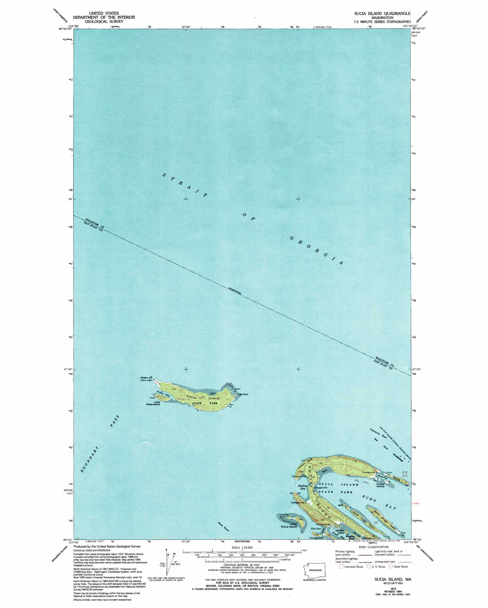
Sucia Island Topo Map Washington
To zoom in, hover over the map of Sucia Island
USGS Topo Quad 48122g8 - 1:24,000 scale
| Topo Map Name: | Sucia Island |
| USGS Topo Quad ID: | 48122g8 |
| Print Size: | ca. 21 1/4" wide x 27" high |
| Southeast Coordinates: | 48.75° N latitude / 122.875° W longitude |
| Map Center Coordinates: | 48.8125° N latitude / 122.9375° W longitude |
| U.S. State: | WA |
| Filename: | o48122g8.jpg |
| Download Map JPG Image: | Sucia Island topo map 1:24,000 scale |
| Map Type: | Topographic |
| Topo Series: | 7.5´ |
| Map Scale: | 1:24,000 |
| Source of Map Images: | United States Geological Survey (USGS) |
| Alternate Map Versions: |
Sucia Island WA 1973, updated 1977 Download PDF Buy paper map Sucia Island WA 1973, updated 1994 Download PDF Buy paper map Sucia Island WA 2011 Download PDF Buy paper map Sucia Island WA 2014 Download PDF Buy paper map |
1:24,000 Topo Quads surrounding Sucia Island
Point Roberts |
Birch Point |
Blaine |
||
Sucia Island |
Lummi Bay |
|||
Stuart Island |
Waldron Island |
Eastsound |
Mount Constitution |
Lummi Island |
Roche Harbor |
Friday Harbor |
Shaw Island |
Blakely Island |
Cypress Island |
> Back to 48122e1 at 1:100,000 scale
> Back to 48122a1 at 1:250,000 scale
> Back to U.S. Topo Maps home
Sucia Island topo map: Gazetteer
Sucia Island: Bars
Clements Reef elevation 0m 0′West Bank elevation 0m 0′
Sucia Island: Bays
Active Cove elevation 0m 0′Echo Bay elevation 0m 0′
Ewing Cove elevation 0m 0′
Fossil Bay elevation 0m 0′
Fox Cove elevation 0m 0′
Mud Bay elevation 0m 0′
Shallow Bay elevation 0m 0′
Sucia Island: Capes
Alden Point elevation 9m 29′Toe Point elevation 6m 19′
Sucia Island: Channels
Strait of Georgia elevation 0m 0′Sucia Island: Cliffs
Lawson Bluff elevation 25m 82′Sucia Island: Islands
Cluster Islands elevation 2m 6′Ewing Island elevation 15m 49′
Harnden Island elevation 10m 32′
Little Patos Island elevation 34m 111′
Little Sucia Island elevation 29m 95′
North Finger Island elevation 31m 101′
Patos Island elevation 31m 101′
South Finger Island elevation 1m 3′
Sucia Island elevation 18m 59′
Sucia Islands elevation 0m 0′
Sucia Island: Parks
Sucia Island State Park elevation 13m 42′Sucia Island digital topo map on disk
Buy this Sucia Island topo map showing relief, roads, GPS coordinates and other geographical features, as a high-resolution digital map file on DVD: