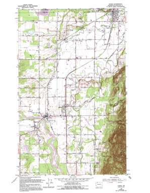
Sumas Topo Map Washington
To zoom in, hover over the map of Sumas
USGS Topo Quad 48122h3 - 1:24,000 scale
| Topo Map Name: | Sumas |
| USGS Topo Quad ID: | 48122h3 |
| Print Size: | ca. 21 1/4" wide x 27" high |
| Southeast Coordinates: | 48.875° N latitude / 122.25° W longitude |
| Map Center Coordinates: | 48.9375° N latitude / 122.3125° W longitude |
| U.S. State: | WA |
| Filename: | o48122h3.jpg |
| Download Map JPG Image: | Sumas topo map 1:24,000 scale |
| Map Type: | Topographic |
| Topo Series: | 7.5´ |
| Map Scale: | 1:24,000 |
| Source of Map Images: | United States Geological Survey (USGS) |
| Alternate Map Versions: |
Sumas WA 1952, updated 1954 Download PDF Buy paper map Sumas WA 1952, updated 1968 Download PDF Buy paper map Sumas WA 1952, updated 1974 Download PDF Buy paper map Sumas WA 1952, updated 1980 Download PDF Buy paper map Sumas WA 1952, updated 1994 Download PDF Buy paper map Sumas WA 2011 Download PDF Buy paper map Sumas WA 2014 Download PDF Buy paper map |
1:24,000 Topo Quads surrounding Sumas
Bertrand Creek |
Lynden |
Sumas |
Kendall |
Maple Falls |
Ferndale |
Bellingham North |
Lawrence |
Deming |
Canyon Lake |
Eliza Island |
Bellingham South |
Lake Whatcom |
Acme |
Cavanaugh Creek |
> Back to 48122e1 at 1:100,000 scale
> Back to 48122a1 at 1:250,000 scale
> Back to U.S. Topo Maps home
Sumas topo map: Gazetteer
Sumas: Populated Places
Clearbrook elevation 21m 68′Everson elevation 26m 85′
Hampton elevation 23m 75′
Nooksack elevation 26m 85′
Strandell elevation 28m 91′
Sumas: Streams
Bone Creek elevation 11m 36′Breckenridge Creek elevation 23m 75′
Dale Creek elevation 33m 108′
Kinney Creek elevation 16m 52′
Squaw Creek elevation 19m 62′
Swift Creek elevation 25m 82′
Sumas: Swamps
Pangborn Lake elevation 40m 131′Sumas digital topo map on disk
Buy this Sumas topo map showing relief, roads, GPS coordinates and other geographical features, as a high-resolution digital map file on DVD:


