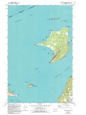
Waldron Island Topo Map Washington
To zoom in, hover over the map of Waldron Island
USGS Topo Quad 48123f1 - 1:24,000 scale
| Topo Map Name: | Waldron Island |
| USGS Topo Quad ID: | 48123f1 |
| Print Size: | ca. 21 1/4" wide x 27" high |
| Southeast Coordinates: | 48.625° N latitude / 123° W longitude |
| Map Center Coordinates: | 48.6875° N latitude / 123.0625° W longitude |
| U.S. State: | WA |
| Filename: | o48123f1.jpg |
| Download Map JPG Image: | Waldron Island topo map 1:24,000 scale |
| Map Type: | Topographic |
| Topo Series: | 7.5´ |
| Map Scale: | 1:24,000 |
| Source of Map Images: | United States Geological Survey (USGS) |
| Alternate Map Versions: |
Waldron Island WA 1954, updated 1957 Download PDF Buy paper map Waldron Island WA 1954, updated 1965 Download PDF Buy paper map Waldron Island WA 1954, updated 1978 Download PDF Buy paper map Waldron Island WA 1954, updated 1995 Download PDF Buy paper map Waldron Island WA 1997, updated 2003 Download PDF Buy paper map Waldron Island WA 2011 Download PDF Buy paper map Waldron Island WA 2014 Download PDF Buy paper map |
1:24,000 Topo Quads surrounding Waldron Island
Point Roberts |
Birch Point |
|||
Sucia Island |
||||
Stuart Island |
Waldron Island |
Eastsound |
Mount Constitution |
|
Roche Harbor |
Friday Harbor |
Shaw Island |
Blakely Island |
|
False Bay |
Richardson |
Lopez Pass |
> Back to 48123e1 at 1:100,000 scale
> Back to 48122a1 at 1:250,000 scale
> Back to U.S. Topo Maps home
Waldron Island topo map: Gazetteer
Waldron Island: Airports
Waldronaire Airport elevation 44m 144′Waldron Island: Bars
Danger Rock elevation 0m 0′Mouatt Reef elevation 0m 0′
Waldron Island: Bays
Cowlitz Bay elevation 0m 0′Mail Bay elevation 0m 0′
North Bay elevation 0m 0′
Seversons Bay elevation 0m 0′
Waldron Island: Capes
Fishery Point elevation 1m 3′Green Point elevation 26m 85′
Limberry Point elevation 5m 16′
Point Disney elevation 2m 6′
Point Hammond elevation 7m 22′
Sandy Point elevation 2m 6′
Waldron Island: Channels
Boundary Pass elevation 0m 0′President Channel elevation 0m 0′
Waldron Island: Dams
Lehman Pond Dam elevation 39m 127′Waldron Island: Islands
Adolphus Island (historical) elevation 0m 0′Bare Island elevation 2m 6′
Flattop Island elevation 51m 167′
Gordon Island elevation 0m 0′
Gull Rock elevation 7m 22′
Shipjack Island elevation 33m 108′
Skipjack Island elevation 22m 72′
Waldron Island elevation 43m 141′
White Rock elevation 6m 19′
Waldron Island: Populated Places
Waldron elevation 9m 29′Waldron Island: Reservoirs
Lehman Pond elevation 39m 127′Waldron Island: Summits
Mount Cement elevation 181m 593′Waldron Island digital topo map on disk
Buy this Waldron Island topo map showing relief, roads, GPS coordinates and other geographical features, as a high-resolution digital map file on DVD:


