Point Roberts Topo Map Washington
To zoom in, hover over the map of Point Roberts
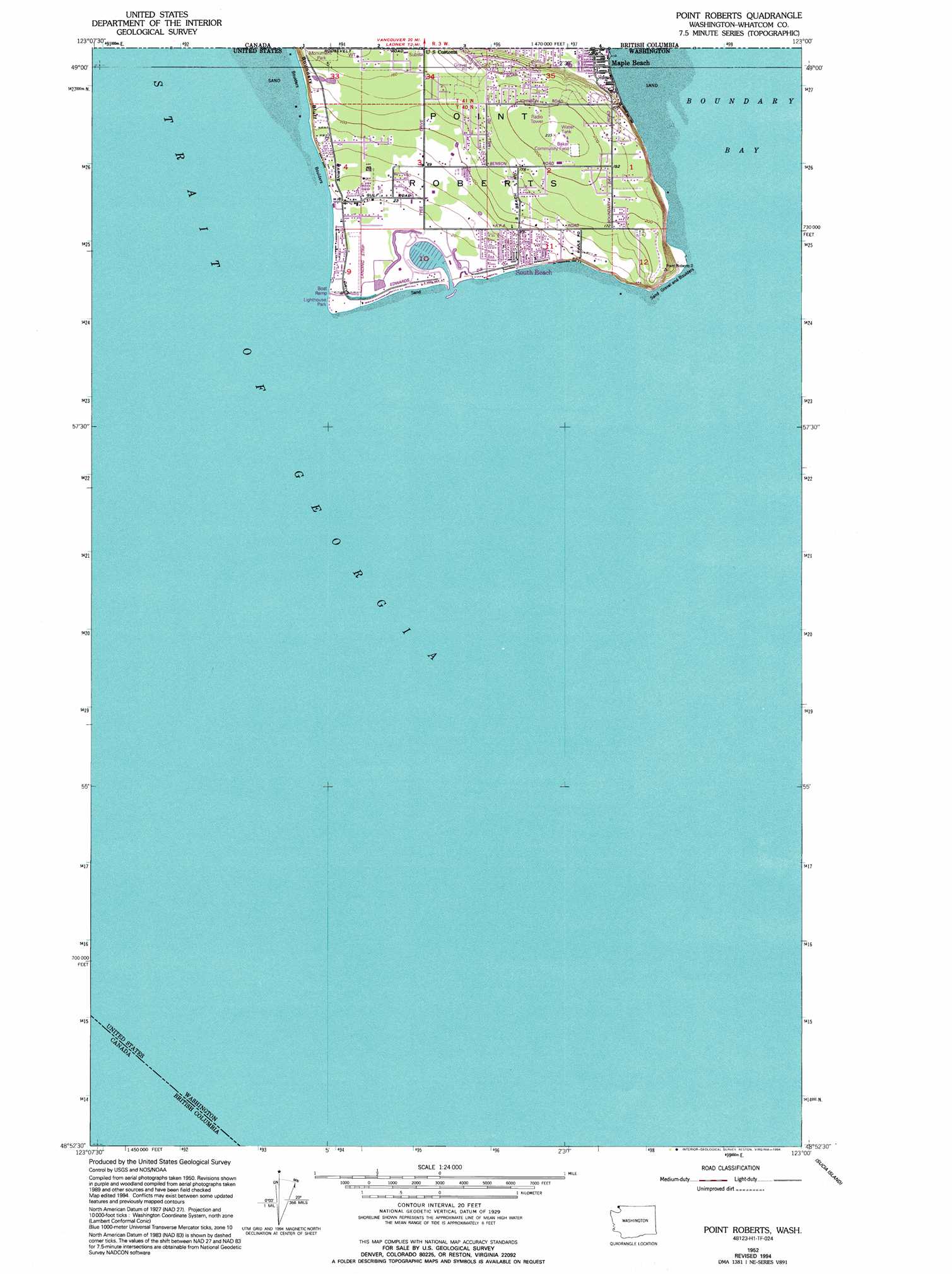
USGS Topo Quad 48123h1 - 1:24,000 scale
| Topo Map Name: | Point Roberts |
| USGS Topo Quad ID: | 48123h1 |
| Print Size: | ca. 21 1/4" wide x 27" high |
| Southeast Coordinates: | 48.875° N latitude / 123° W longitude |
| Map Center Coordinates: | 48.9375° N latitude / 123.0625° W longitude |
| U.S. State: | WA |
| Filename: | o48123h1.jpg |
| Download Map JPG Image: | Point Roberts topo map 1:24,000 scale |
| Map Type: | Topographic |
| Topo Series: | 7.5´ |
| Map Scale: | 1:24,000 |
| Source of Map Images: | United States Geological Survey (USGS) |
| Alternate Map Versions: |
Point Roberts WA 1952, updated 1954 Download PDF Buy paper map Point Roberts WA 1952, updated 1963 Download PDF Buy paper map Point Roberts WA 1952, updated 1973 Download PDF Buy paper map Point Roberts WA 1952, updated 1981 Download PDF Buy paper map Point Roberts WA 1952, updated 1994 Download PDF Buy paper map Point Roberts WA 1997, updated 2003 Download PDF Buy paper map Point Roberts WA 2011 Download PDF Buy paper map Point Roberts WA 2014 Download PDF Buy paper map |
1:24,000 Topo Quads surrounding Point Roberts
Point Roberts |
Birch Point |
|||
Sucia Island |
||||
Stuart Island |
Waldron Island |
Eastsound |
Mount Constitution |
> Back to 48123e1 at 1:100,000 scale
> Back to 48122a1 at 1:250,000 scale
> Back to U.S. Topo Maps home
Point Roberts topo map: Gazetteer
Point Roberts: Airports
Point Roberts Airport-Young Field elevation 6m 19′Point Roberts: Bays
Boundary Bay elevation 0m 0′Point Roberts: Capes
Point Roberts elevation 49m 160′Point Roberts: Cliffs
Boundary Bluff elevation 22m 72′Point Roberts: Populated Places
Point Roberts elevation 10m 32′South Beach elevation 11m 36′
Point Roberts digital topo map on disk
Buy this Point Roberts topo map showing relief, roads, GPS coordinates and other geographical features, as a high-resolution digital map file on DVD: