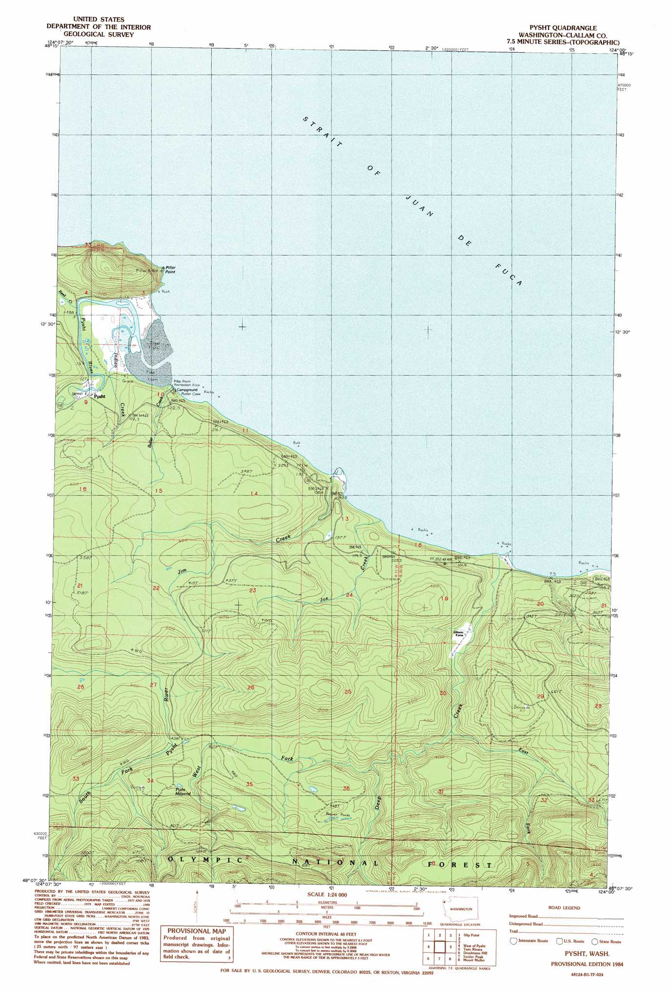
Pysht Topo Map Washington
To zoom in, hover over the map of Pysht
USGS Topo Quad 48124b1 - 1:24,000 scale
| Topo Map Name: | Pysht |
| USGS Topo Quad ID: | 48124b1 |
| Print Size: | ca. 21 1/4" wide x 27" high |
| Southeast Coordinates: | 48.125° N latitude / 124° W longitude |
| Map Center Coordinates: | 48.1875° N latitude / 124.0625° W longitude |
| U.S. State: | WA |
| Filename: | o48124b1.jpg |
| Download Map JPG Image: | Pysht topo map 1:24,000 scale |
| Map Type: | Topographic |
| Topo Series: | 7.5´ |
| Map Scale: | 1:24,000 |
| Source of Map Images: | United States Geological Survey (USGS) |
| Alternate Map Versions: |
Pysht WA 1984, updated 1984 Download PDF Buy paper map Pysht WA 2011 Download PDF Buy paper map Pysht WA 2014 Download PDF Buy paper map |
| FStopo: | US Forest Service topo Pysht is available: Download FStopo PDF Download FStopo TIF |
1:24,000 Topo Quads surrounding Pysht
Clallam Bay |
Slip Point |
|||
Ellis Mountain |
West Of Pysht |
Pysht |
Twin Rivers |
Disque |
Lake Pleasant |
Deadmans Hill |
Snider Peak |
Mount Muller |
Lake Crescent |
Reade Hill |
Indian Pass |
Hunger Mountain |
Slide Peak |
Bogachiel Peak |
> Back to 48124a1 at 1:100,000 scale
> Back to 48124a1 at 1:250,000 scale
> Back to U.S. Topo Maps home
Pysht topo map: Gazetteer
Pysht: Bays
Butler Cove elevation 0m 0′Pysht: Capes
Pillar Point elevation 0m 0′Pysht: Cliffs
Tree Bluff elevation 17m 55′Pysht: Lakes
Pysht Millpond elevation 179m 587′Pysht: Parks
Pillar Point Recreation Area elevation 0m 0′Pysht: Populated Places
Pysht elevation 6m 19′Pysht: Streams
Butler Creek elevation 18m 59′Deep Creek elevation 4m 13′
East Fork Deep Creek elevation 43m 141′
Indian Creek elevation 4m 13′
Jim Creek elevation 0m 0′
Joe Creek elevation 0m 0′
Pysht River elevation 0m 0′
Reed Creek elevation 3m 9′
West Fork Deep Creek elevation 104m 341′
Pysht digital topo map on disk
Buy this Pysht topo map showing relief, roads, GPS coordinates and other geographical features, as a high-resolution digital map file on DVD: