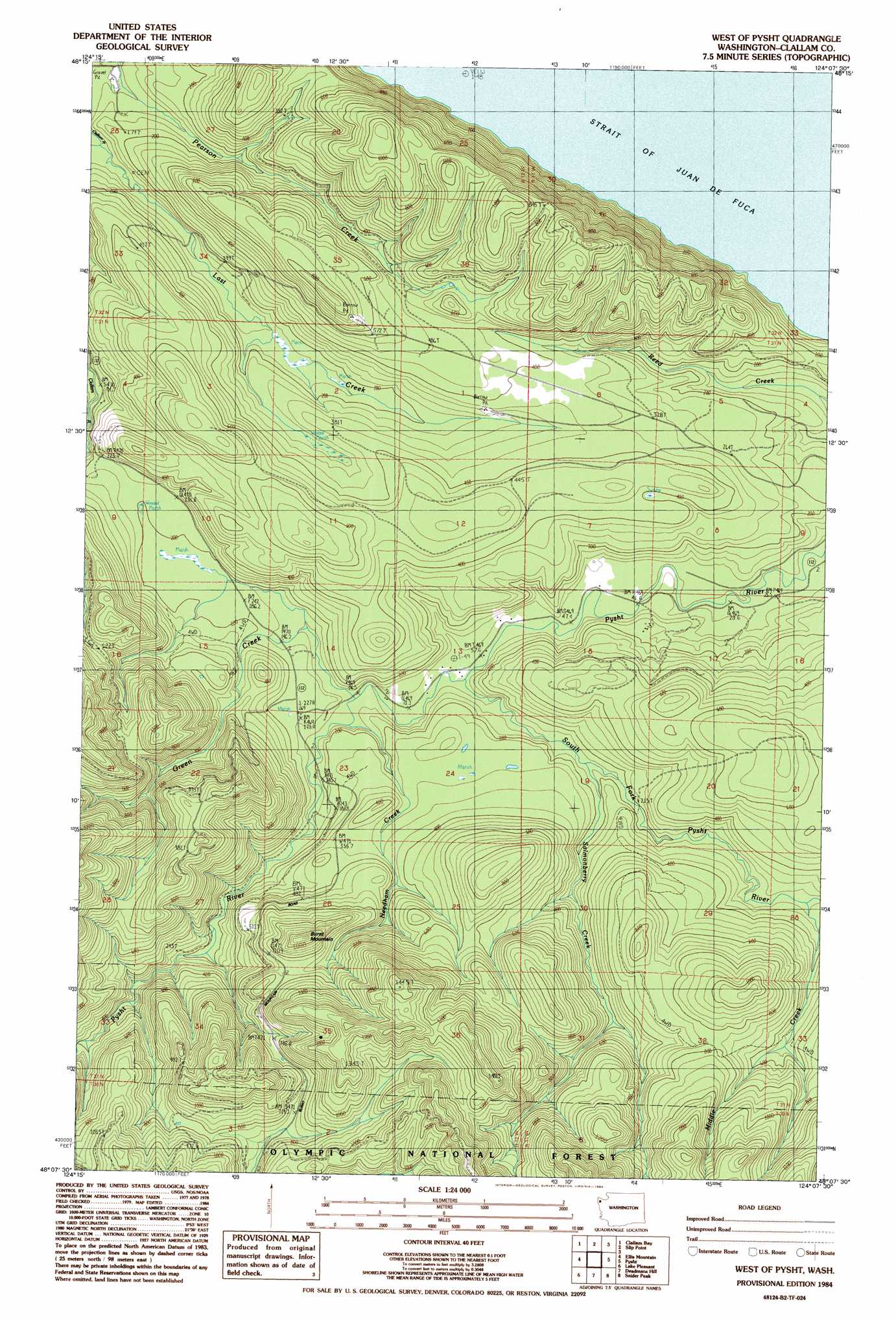
West Of Pysht Topo Map Washington
To zoom in, hover over the map of West Of Pysht
USGS Topo Quad 48124b2 - 1:24,000 scale
| Topo Map Name: | West Of Pysht |
| USGS Topo Quad ID: | 48124b2 |
| Print Size: | ca. 21 1/4" wide x 27" high |
| Southeast Coordinates: | 48.125° N latitude / 124.125° W longitude |
| Map Center Coordinates: | 48.1875° N latitude / 124.1875° W longitude |
| U.S. State: | WA |
| Filename: | o48124b2.jpg |
| Download Map JPG Image: | West Of Pysht topo map 1:24,000 scale |
| Map Type: | Topographic |
| Topo Series: | 7.5´ |
| Map Scale: | 1:24,000 |
| Source of Map Images: | United States Geological Survey (USGS) |
| Alternate Map Versions: |
West of Pysht WA 1984, updated 1984 Download PDF Buy paper map West of Pysht WA 2011 Download PDF Buy paper map West of Pysht WA 2014 Download PDF Buy paper map |
| FStopo: | US Forest Service topo West of Pysht is available: Download FStopo PDF Download FStopo TIF |
1:24,000 Topo Quads surrounding West Of Pysht
Sekiu River |
Clallam Bay |
Slip Point |
||
Hoko Falls |
Ellis Mountain |
West Of Pysht |
Pysht |
Twin Rivers |
Gunderson Mountain |
Lake Pleasant |
Deadmans Hill |
Snider Peak |
Mount Muller |
Forks |
Reade Hill |
Indian Pass |
Hunger Mountain |
Slide Peak |
> Back to 48124a1 at 1:100,000 scale
> Back to 48124a1 at 1:250,000 scale
> Back to U.S. Topo Maps home
West Of Pysht topo map: Gazetteer
West Of Pysht: Streams
Green Creek elevation 26m 85′Middle Creek elevation 81m 265′
Needham Creek elevation 29m 95′
Salmonberry Creek elevation 45m 147′
South Fork Pysht River elevation 23m 75′
West Of Pysht: Summits
Burnt Mountain elevation 330m 1082′West Of Pysht digital topo map on disk
Buy this West Of Pysht topo map showing relief, roads, GPS coordinates and other geographical features, as a high-resolution digital map file on DVD: