Neah Bay Topo Map Washington
To zoom in, hover over the map of Neah Bay
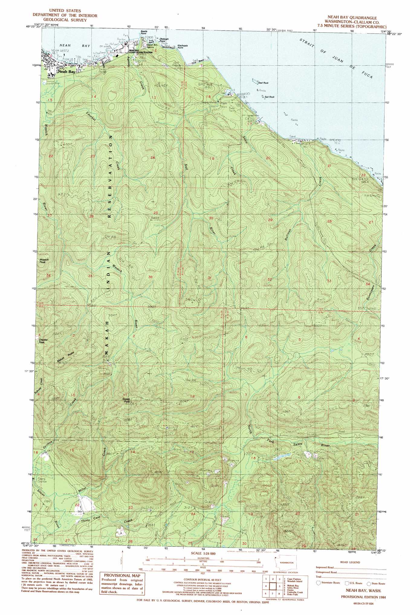
USGS Topo Quad 48124c5 - 1:24,000 scale
| Topo Map Name: | Neah Bay |
| USGS Topo Quad ID: | 48124c5 |
| Print Size: | ca. 21 1/4" wide x 27" high |
| Southeast Coordinates: | 48.25° N latitude / 124.5° W longitude |
| Map Center Coordinates: | 48.3125° N latitude / 124.5625° W longitude |
| U.S. State: | WA |
| Filename: | o48124c5.jpg |
| Download Map JPG Image: | Neah Bay topo map 1:24,000 scale |
| Map Type: | Topographic |
| Topo Series: | 7.5´ |
| Map Scale: | 1:24,000 |
| Source of Map Images: | United States Geological Survey (USGS) |
| Alternate Map Versions: |
Neah Bay WA 1984, updated 1984 Download PDF Buy paper map Neah Bay WA 2011 Download PDF Buy paper map Neah Bay WA 2014 Download PDF Buy paper map |
1:24,000 Topo Quads surrounding Neah Bay
Cape Flattery |
||||
Waadah Island |
Makah Bay |
Neah Bay |
||
Sekiu River |
Clallam Bay |
Ozette |
Umbrella Creek |
Hoko Falls |
Ellis Mountain |
Allens Bay |
Dickey Lake |
Gunderson Mountain |
Lake Pleasant |
> Back to 48124a1 at 1:100,000 scale
> Back to 48124a1 at 1:250,000 scale
> Back to U.S. Topo Maps home
Neah Bay topo map: Gazetteer
Neah Bay: Bars
Sail Rock elevation 0m 0′Seal Rock elevation 1m 3′
Neah Bay: Beaches
First Beach elevation 0m 0′Second Beach elevation 0m 0′
Third Beach elevation 9m 29′
Neah Bay: Capes
Baada Point elevation 1m 3′Dtokoah Point elevation 2m 6′
Klachopis Point elevation 0m 0′
Neah Bay: Populated Places
Neah Bay elevation 2m 6′Neah Bay: Streams
Agency Creek elevation 1m 3′Bullman Creek elevation 0m 0′
Educket Creek elevation 10m 32′
Halfway Creek elevation 0m 0′
Miller Creek elevation 19m 62′
Oleho River (historical) elevation 0m 0′
Sail River elevation 3m 9′
Snow Creek elevation 10m 32′
Thirty Cent Creek elevation 22m 72′
Neah Bay: Summits
Makah Peaks elevation 502m 1646′Sooes Peak elevation 602m 1975′
Neah Bay digital topo map on disk
Buy this Neah Bay topo map showing relief, roads, GPS coordinates and other geographical features, as a high-resolution digital map file on DVD: