Angle Inlet Topo Map Minnesota
To zoom in, hover over the map of Angle Inlet
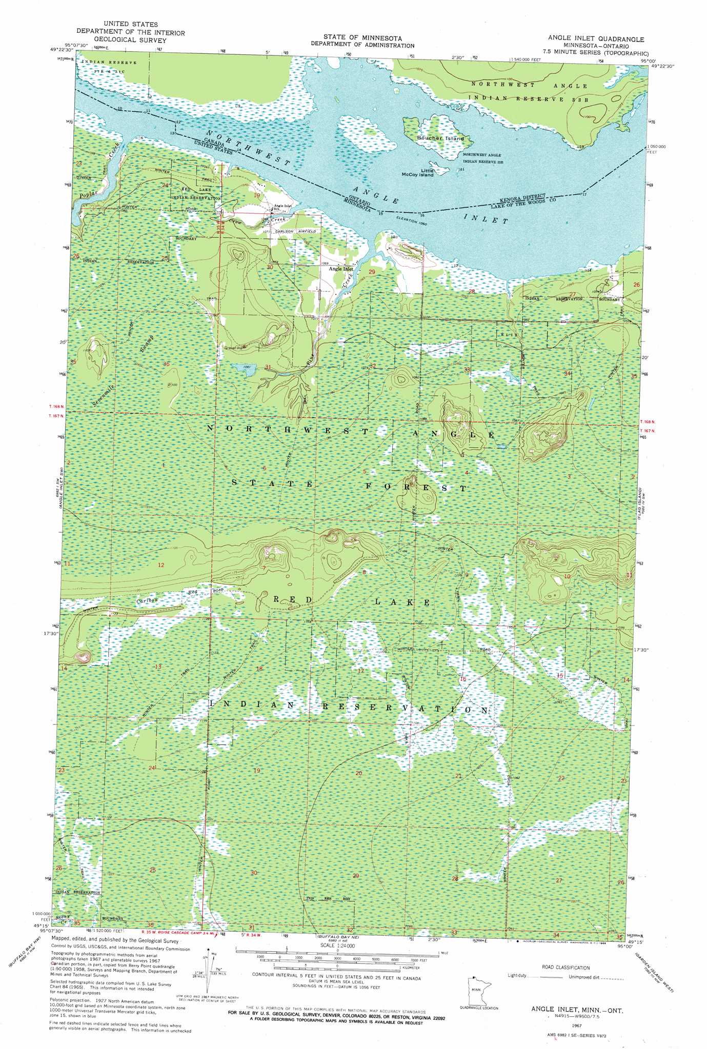
USGS Topo Quad 49095c1 - 1:24,000 scale
| Topo Map Name: | Angle Inlet |
| USGS Topo Quad ID: | 49095c1 |
| Print Size: | ca. 21 1/4" wide x 27" high |
| Southeast Coordinates: | 49.25° N latitude / 95° W longitude |
| Map Center Coordinates: | 49.3125° N latitude / 95.0625° W longitude |
| U.S. State: | MN |
| Filename: | o49095c1.jpg |
| Download Map JPG Image: | Angle Inlet topo map 1:24,000 scale |
| Map Type: | Topographic |
| Topo Series: | 7.5´ |
| Map Scale: | 1:24,000 |
| Source of Map Images: | United States Geological Survey (USGS) |
| Alternate Map Versions: |
Angle Inlet MN 1967, updated 1969 Download PDF Buy paper map Angle Inlet MN 2010 Download PDF Buy paper map Angle Inlet MN 2013 Download PDF Buy paper map Angle Inlet MN 2016 Download PDF Buy paper map |
1:24,000 Topo Quads surrounding Angle Inlet
Angle Inlet Sw |
Angle Inlet |
Flag Island |
Oak Island |
|
Buffalo Bay Nw |
Buffalo Bay Ne |
Garden Island West |
Garden Island East |
|
> Back to 49095a1 at 1:100,000 scale
> Back to 49094a1 at 1:250,000 scale
> Back to U.S. Topo Maps home
Angle Inlet topo map: Gazetteer
Angle Inlet: Airports
Northwest Angle Airport elevation 325m 1066′Angle Inlet: Bays
Northwest Angle Inlet elevation 324m 1062′Angle Inlet: Populated Places
Angle Inlet elevation 324m 1062′Angle Inlet: Post Offices
Angle Inlet Post Office elevation 323m 1059′Angle Inlet: Streams
Crow Creek elevation 324m 1062′Pine Creek elevation 323m 1059′
Poplar Creek elevation 323m 1059′
Angle Inlet: Swamps
Caribou Bog elevation 343m 1125′Sevenmile Swamp elevation 333m 1092′
Angle Inlet digital topo map on disk
Buy this Angle Inlet topo map showing relief, roads, GPS coordinates and other geographical features, as a high-resolution digital map file on DVD: