Las Palomas Wildlife Management Area - Arroyo Colorado Unit, TX
Interactive topo map of Las Palomas Wildlife Management Area - Arroyo Colorado Unit, TX
| Place Name: | Las Palomas Wildlife Management Area - Arroyo Colorado Unit |
| Feature Class: | Park |
| US State: | TX |
| County: | Cameron |
| Latitude: | 26.32 |
| Longitude: | -97.51 |
| Elevation (meters): | 4 m |
| Elevation (feet): | 13′ |
| USGS Quad: | Paso Real topo map |
| 7.5´ topo: | 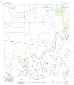 |
| State topo index: | TX topo index |
| Alternate map versions: | TX topographic maps Editions by year, direct download as GeoPDF. |
| 30´ x 60´ topo: | 1:100,000 scale map |
| 1° x 2° topo: | 1:250,000 scale map |